Lecture 6: Understanding Climate Data Structures: Grid, Time and Level
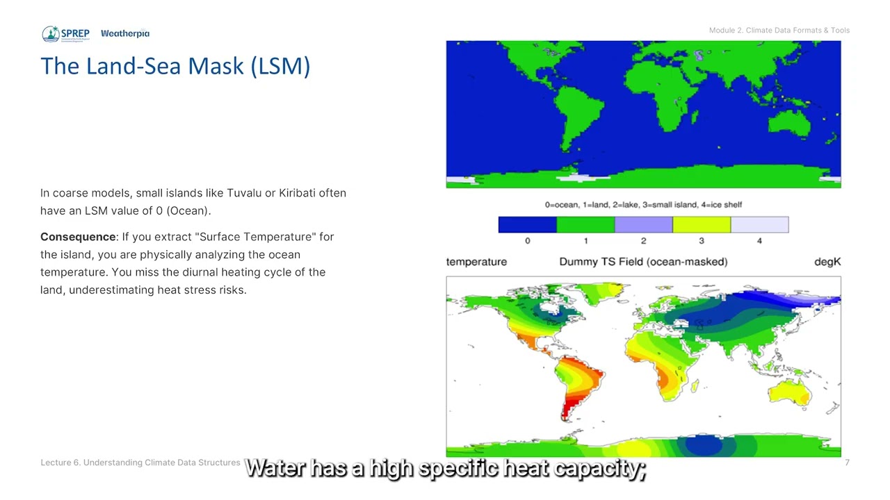
Deep dives into dimensions, variables and metadata while addressing Pacific-specific challenges like 0–360° longitude handling and land-sea masks on small atolls.
Mapping the ocean floor
Explore how scientists map the ocean floor and why it’s so important for understanding our planet. #OceanMapping #SeafloorMapping #MarineScience #Oceanography #SonarTechnology #DeepSeaExploration #...


The S-101 standard for Electronic Navigational Chart (ENC) offers dynamic features, such as the possibility for more up-to-date data on currents or tides, as well as for the use of multiple languag...