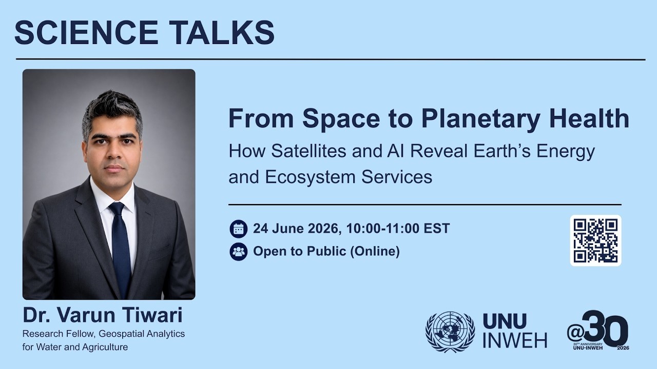
Earth’s surface continuously regulates the planet’s energy balance by reflecting a portion of incoming solar radiation back into space, a process commonly described through surface albedo. Variatio...

Earth’s surface continuously regulates the planet’s energy balance by reflecting a portion of incoming solar radiation back into space, a process commonly described through surface albedo. Variatio...
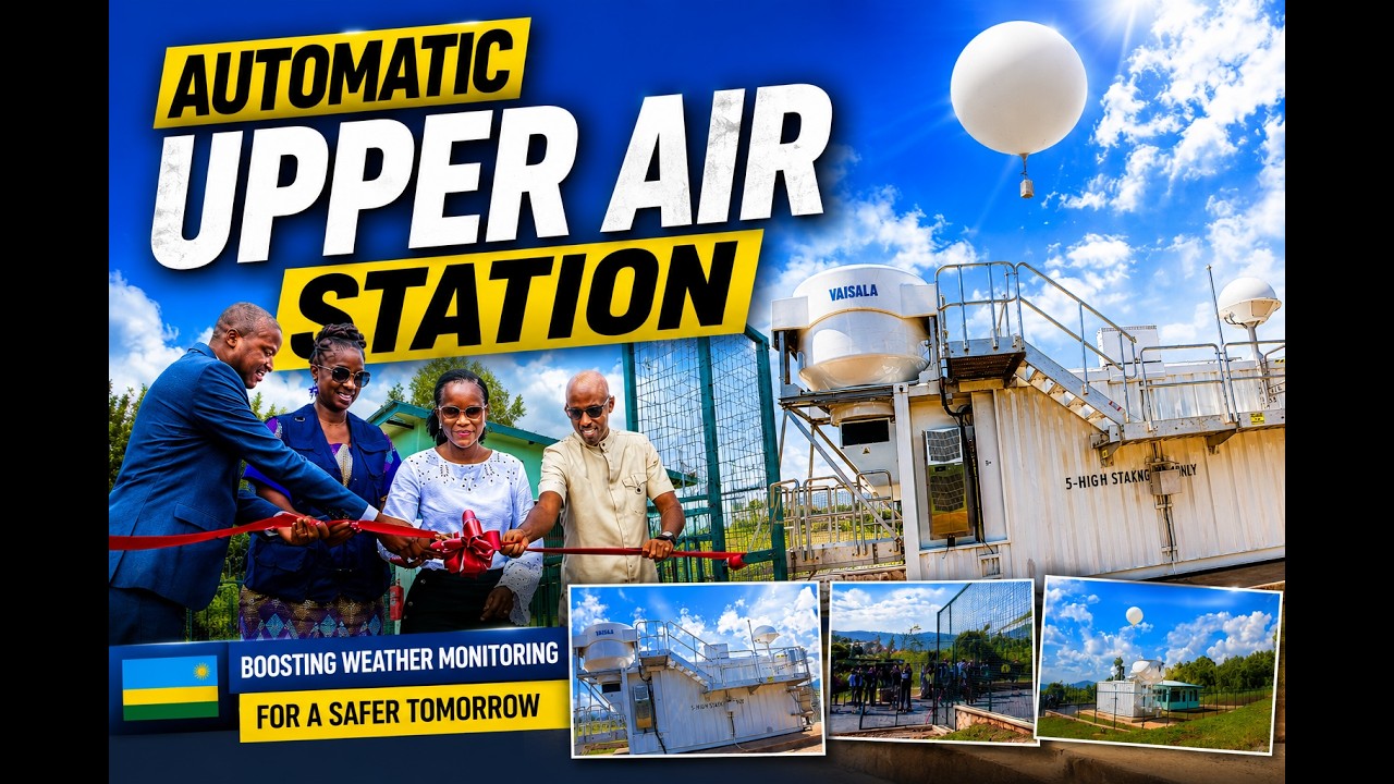
... Upper-Air Station in Huye District, marking a major milestone in the country's meteorological and climate monitoring capabilities.
The state-of-the-art facility, established under the...

Every summer, Europe watches millions of hectares burn. But quietly, the EU is helping to build something most people don't know exists, a real-time wildfire detection and response system that runs...
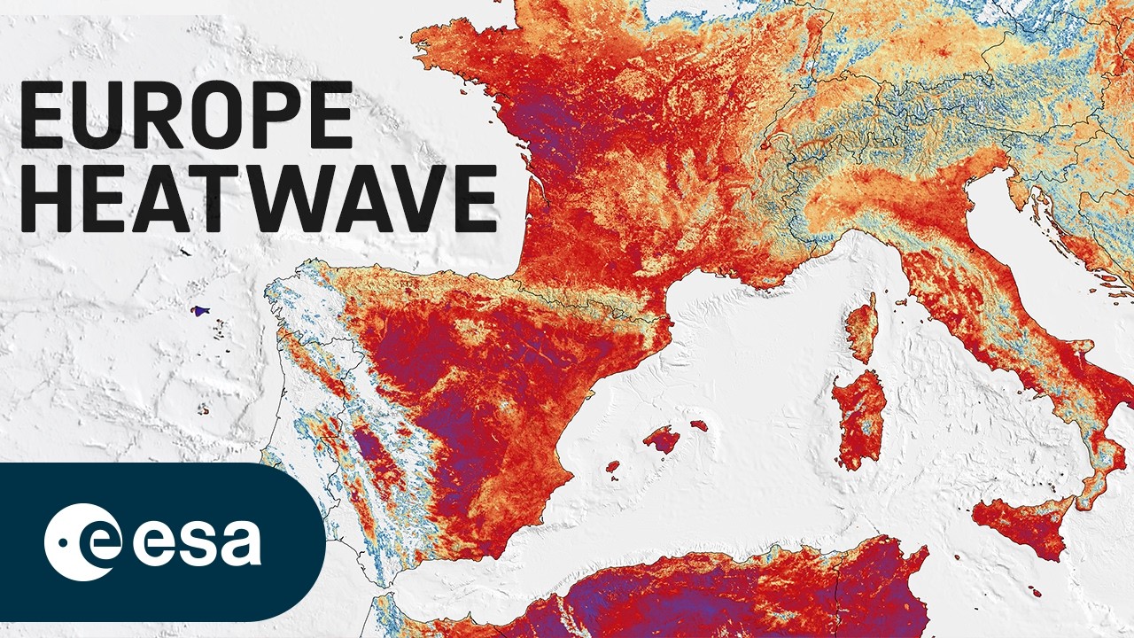
Europe is facing an intense heatwave, with record temperatures and several cities under red alert. On 23 June, France recorded its hottest June day ever.
This image was captured the same day by th...
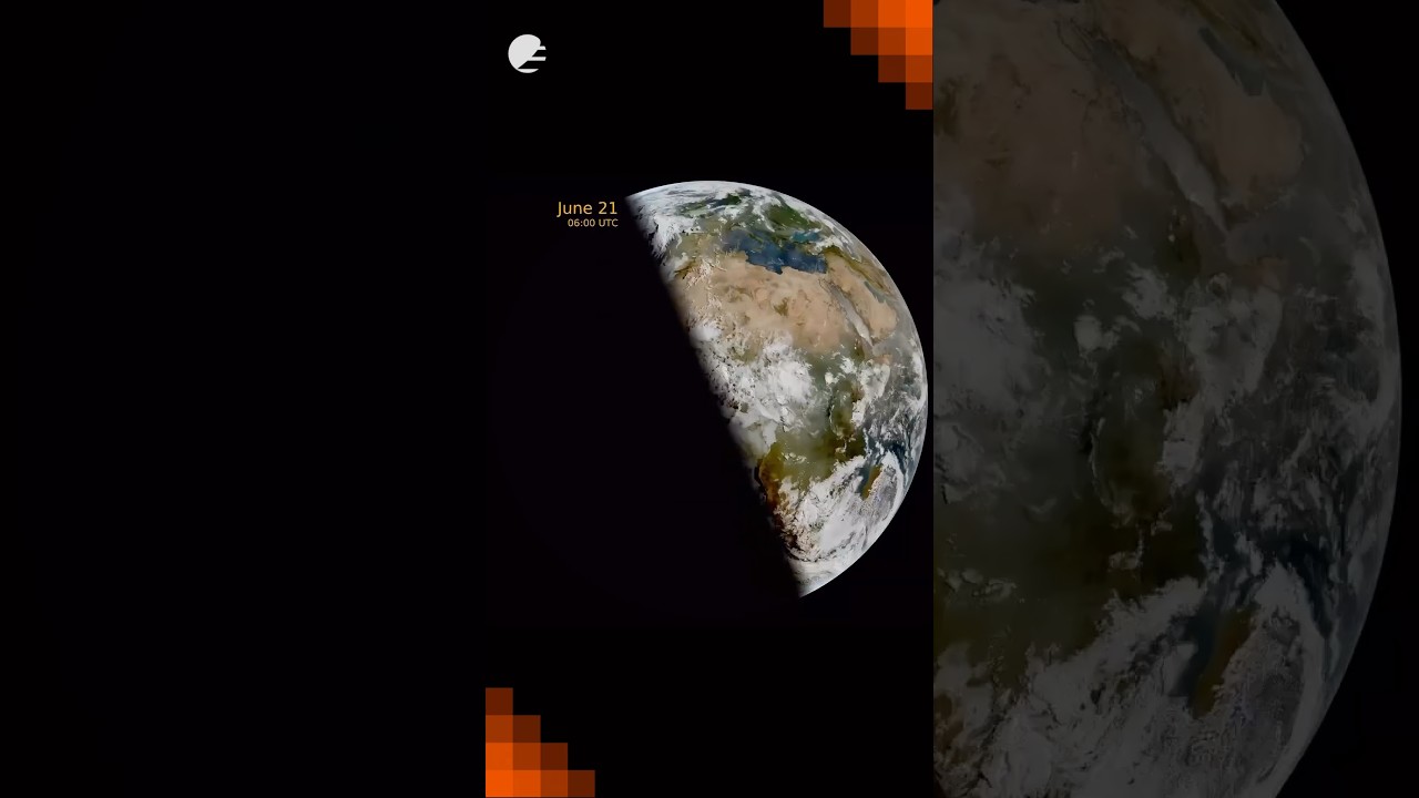
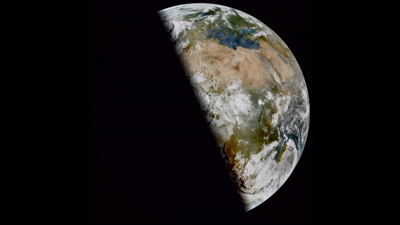
This animation shows daily snapshots at 06:00 UTC from Meteosat-12’s Flexible Combined Imager, tracking the terminator (the line between day and night) as it swings from the December solstice, thro...
Watch our making-of and the effort that went into capturing this special moment. 👀
On Friday we marked 40 years of serving our Member States and the planet. 🛰
Here’s to the people behind the data.
Yesterday, 08:24 UTC (10:24 CEST) marked the June solstice - the longest day of the year in the Northern Hemisphere, and the moment Earth’s tilt points us most directly at the sun. ☀️
From geosta...
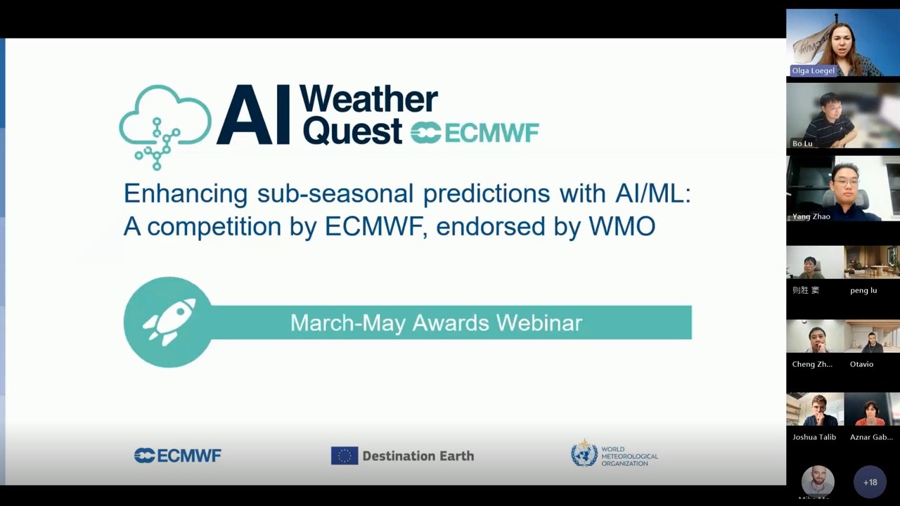
...ib (ECMWF), Gabriela Aznar (MeteoSwiss), Bo Lu / Yang Zhao / Zesheng Dou (China Meteorological Administration), Cheng Zeng (Stony Brook University) and Otavio Medeiros Feitosa (INPE - I...
Module 3 Lecture 1: Introduction to HaiYang Satellites
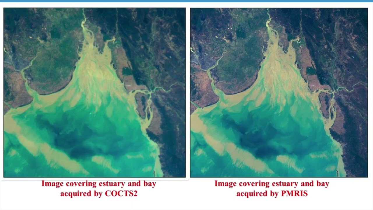
...apply Chinese Earth observation satellite data — including optical, SAR, ocean, meteorological, and nighttime light imagery — to real-world sustainable development challenges such as di...
Module 5 Lecture 3 Applications of Luojia 3 Satellites
...apply Chinese Earth observation satellite data — including optical, SAR, ocean, meteorological, and nighttime light imagery — to real-world sustainable development challenges such as di...
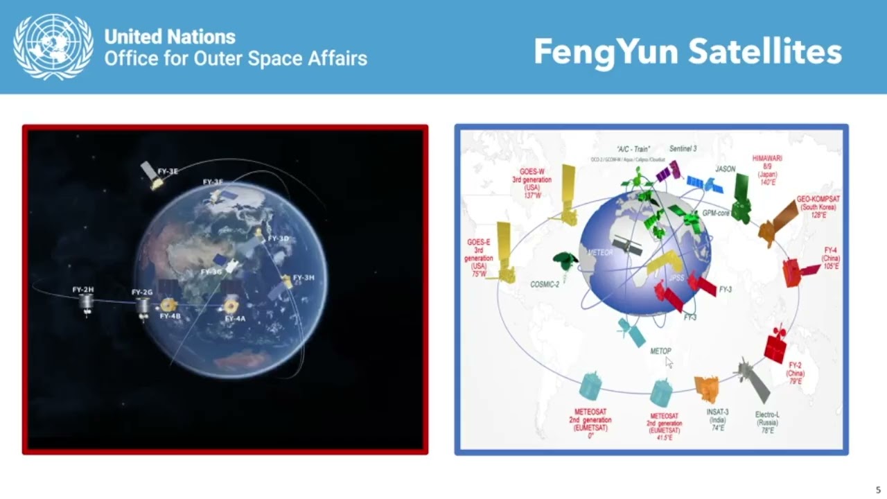
Module 2 Lecture 1 Overview of Fengyun Meteorological Satellites

...apply Chinese Earth observation satellite data — including optical, SAR, ocean, meteorological, and nighttime light imagery — to real-world sustainable development challenges such as di...
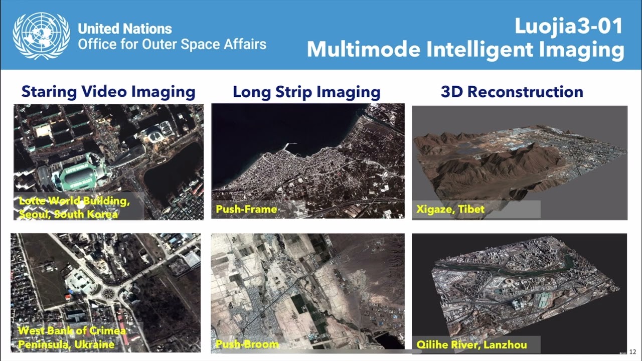
Module 5 Lecture 1 Luojia Series Remote Sensing Satellite
...apply Chinese Earth observation satellite data — including optical, SAR, ocean, meteorological, and nighttime light imagery — to real-world sustainable development challenges such as di...
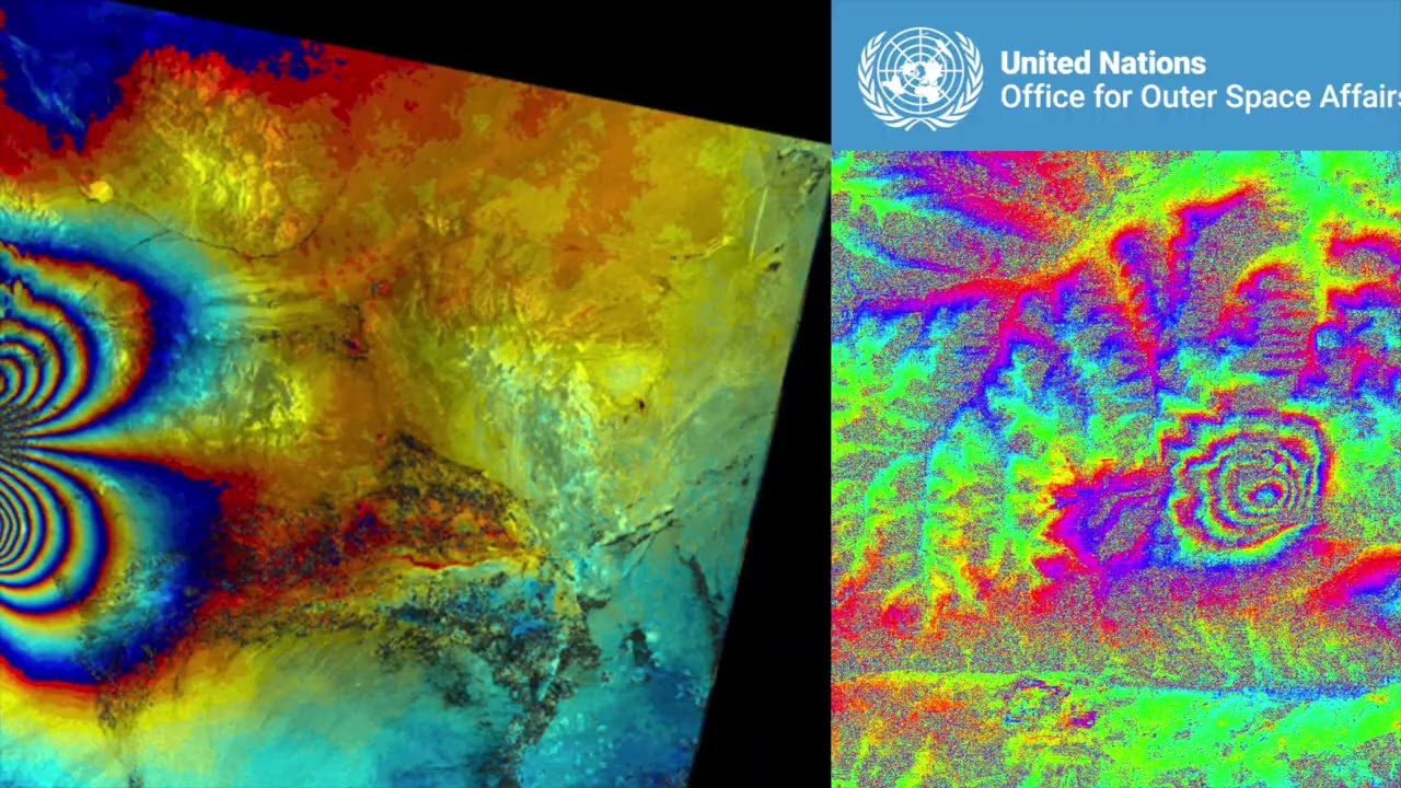
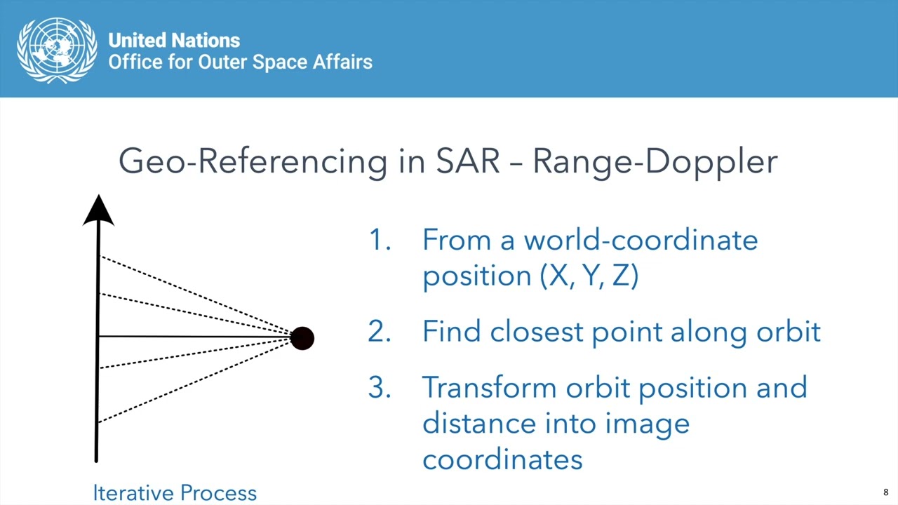
Module 1 Lecture 2 Using Chinese SAR Satellites for Interferometry
...apply Chinese Earth observation satellite data — including optical, SAR, ocean, meteorological, and nighttime light imagery — to real-world sustainable development challenges such as di...
Module 4 Lesson 1 Introduction to High Resolution Optical Remote Sensing Satellite
...apply Chinese Earth observation satellite data — including optical, SAR, ocean, meteorological, and nighttime light imagery — to real-world sustainable development challenges such as di...
Module 5 Lecture 4 Hyperspectral Applications of Qimingxing 1 and Luojia 4A

...apply Chinese Earth observation satellite data — including optical, SAR, ocean, meteorological, and nighttime light imagery — to real-world sustainable development challenges such as di...
Module 1 Lecture 1 Introduction to Chinese Radar Remote Sensing Satellites
...apply Chinese Earth observation satellite data — including optical, SAR, ocean, meteorological, and nighttime light imagery — to real-world sustainable development challenges such as di...
Module 1 Lecture 3 The Calibration andValidation on Chinese SAR Satellites
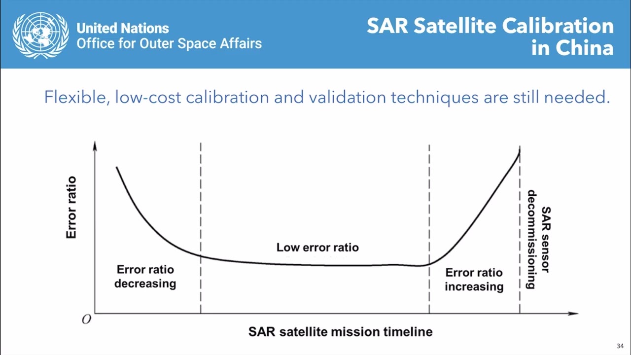
...apply Chinese Earth observation satellite data — including optical, SAR, ocean, meteorological, and nighttime light imagery — to real-world sustainable development challenges such as di...
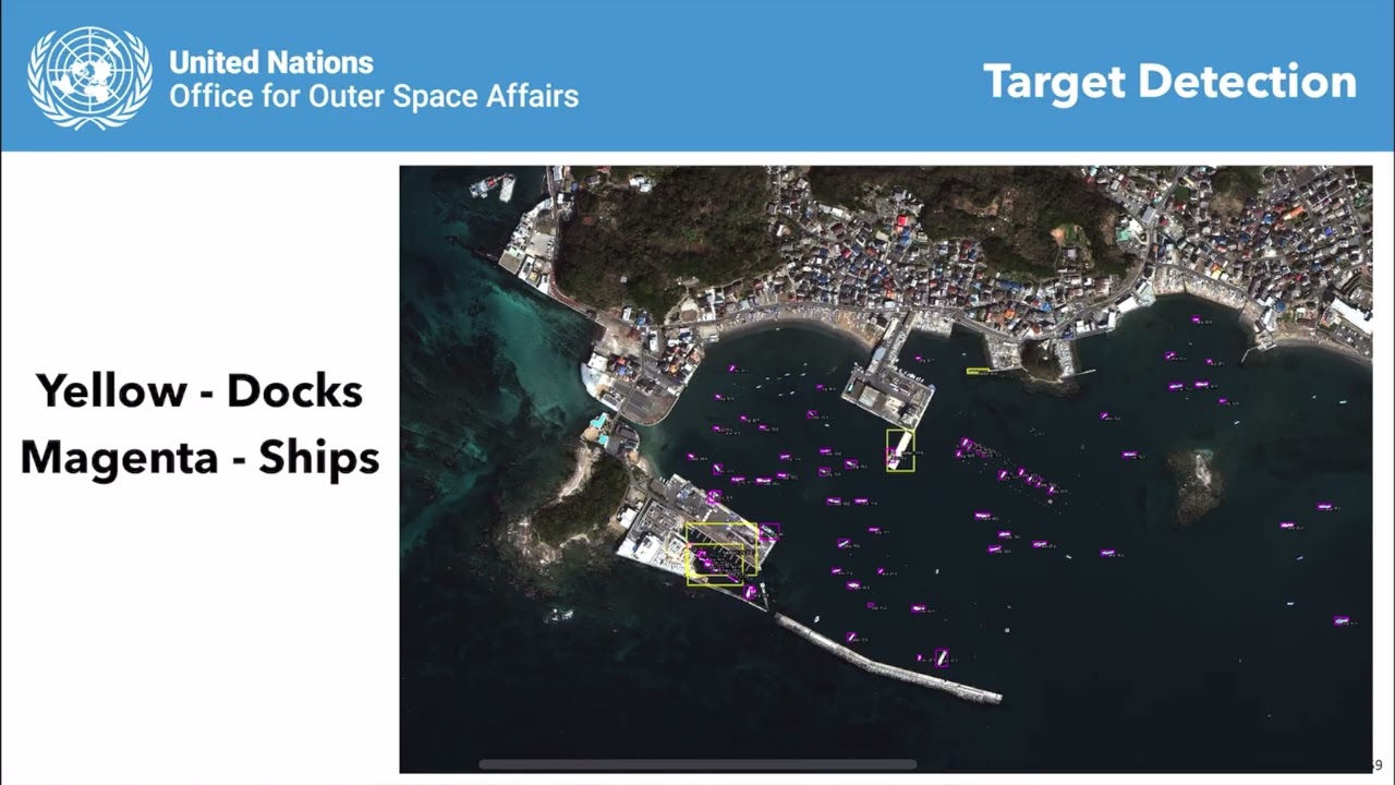
Module 4 Lecture 4 Post Disaster Damage Assessment with High Resolution Optical Satellite Imagery
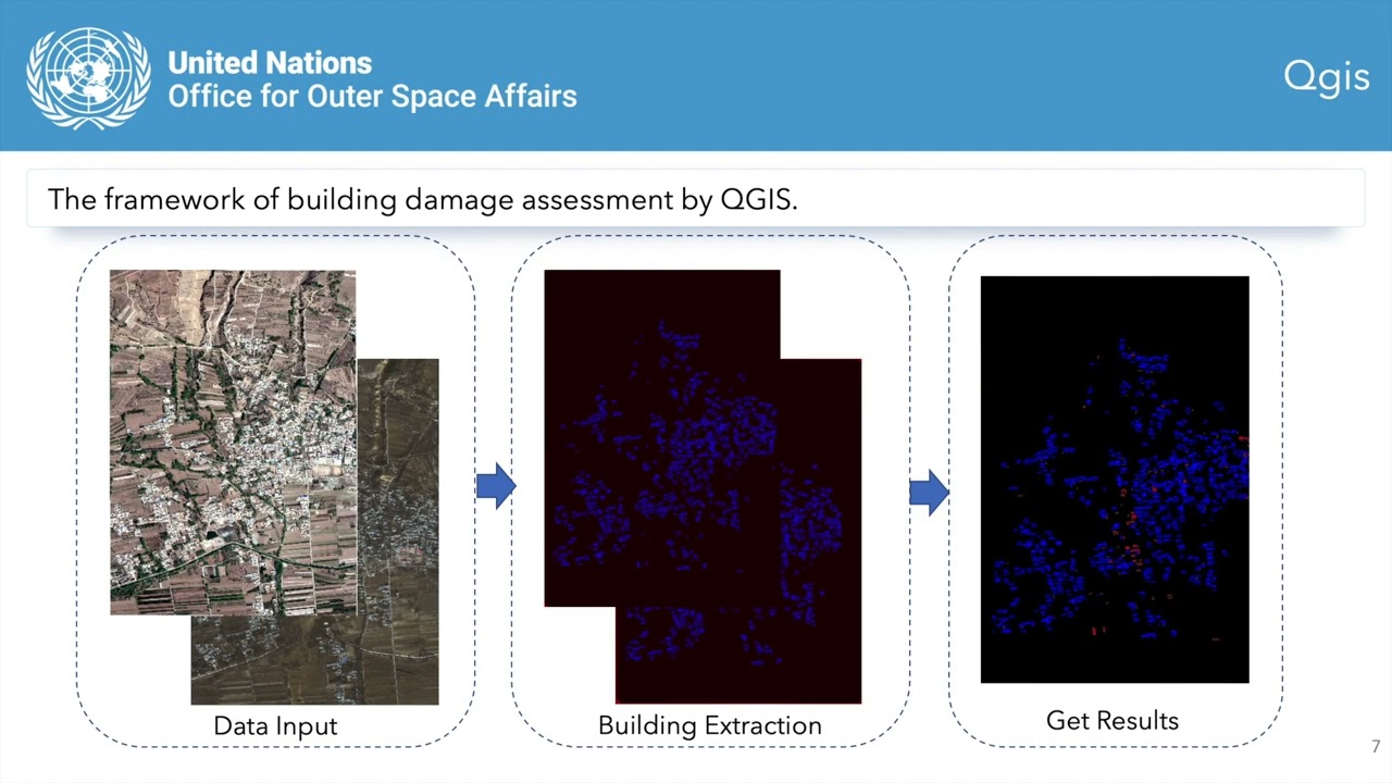
...apply Chinese Earth observation satellite data — including optical, SAR, ocean, meteorological, and nighttime light imagery — to real-world sustainable development challenges such as di...
Module 2 Lecture 3: Application of Fengyun Satellite Data in Extreme Weather Monitoring Case Study
...apply Chinese Earth observation satellite data — including optical, SAR, ocean, meteorological, and nighttime light imagery — to real-world sustainable development challenges such as di...