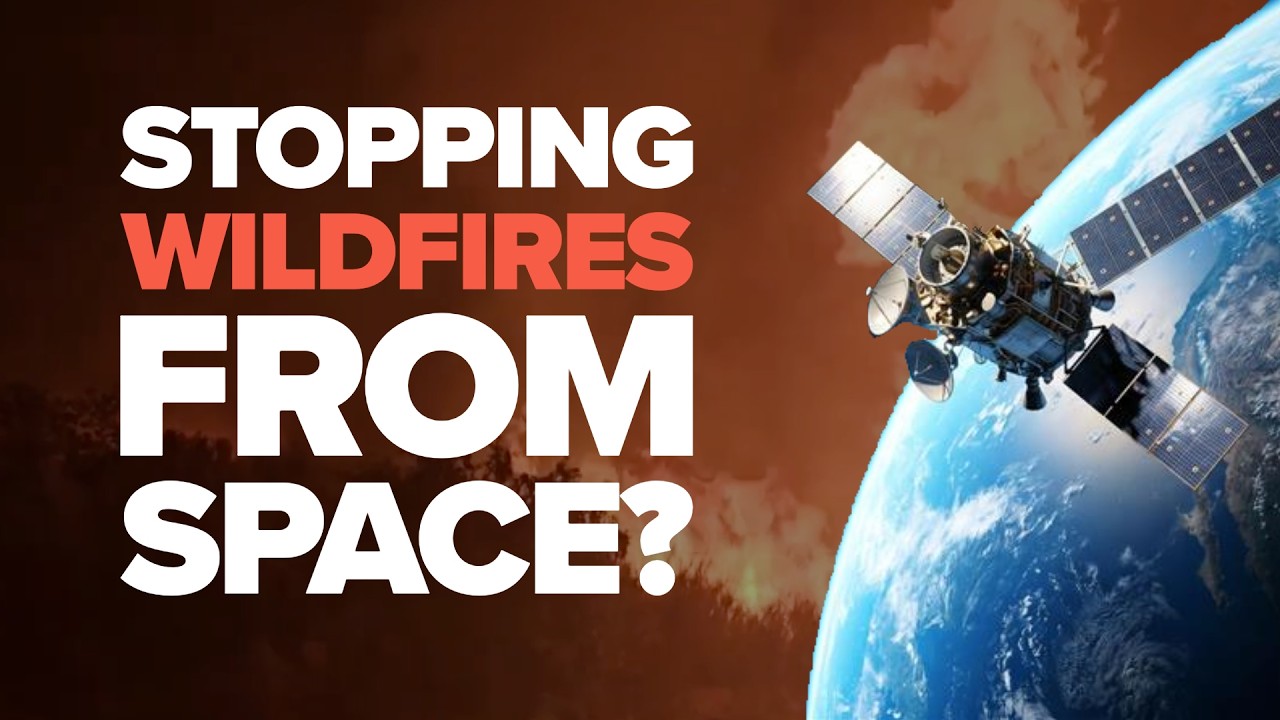
Every summer, Europe watches millions of hectares burn. But quietly, the EU is helping to build something most people don't know exists, a real-time wildfire detection and response system that runs...
Every summer, Europe watches millions of hectares burn. But quietly, the EU is helping to build something most people don't know exists, a real-time wildfire detection and response system that runs...
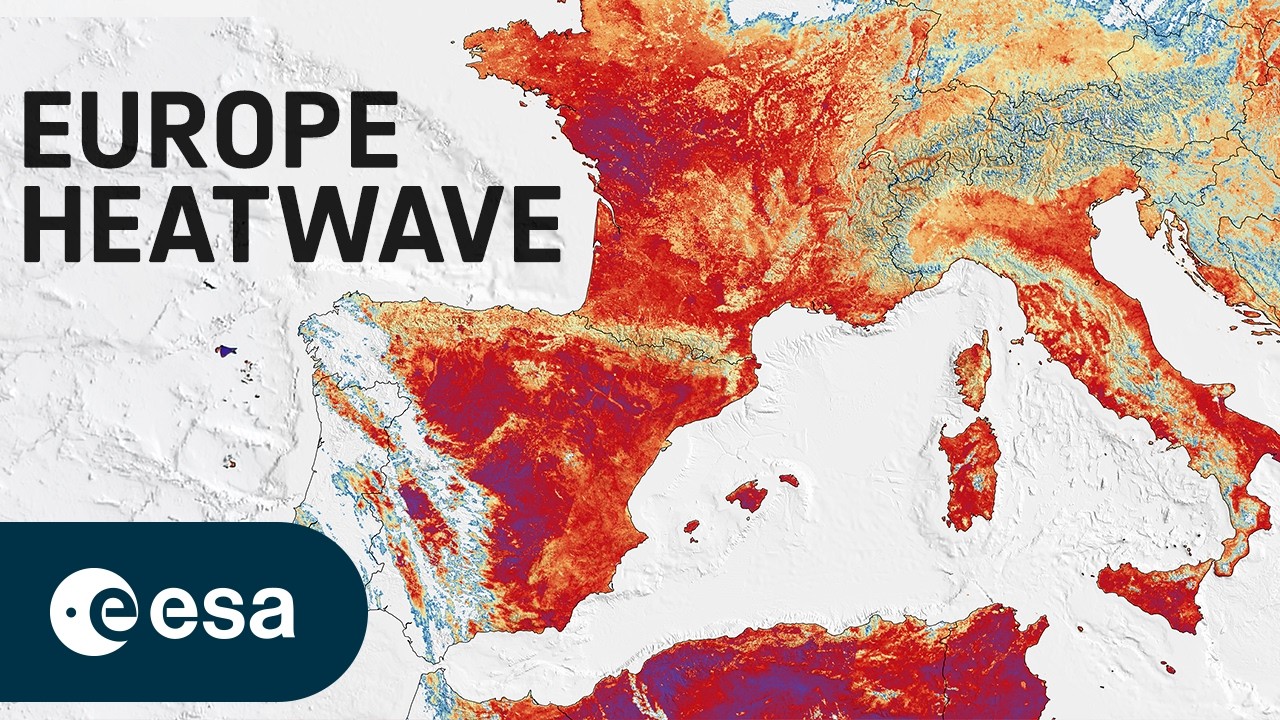
Europe is facing an intense heatwave, with record temperatures and several cities under red alert. On 23 June, France recorded its hottest June day ever.
This image was captured the same day by th...
Watch our making-of and the effort that went into capturing this special moment. 👀
On Friday we marked 40 years of serving our Member States and the planet. 🛰
Here’s to the people behind the data.
Together, STAR-C and the GCC can serve as platforms for innovation, technical collaboration, and best-practice sharing, helping countries accelerate solar deployment, grid modernization, and the ad...
ISA’s STAR Centres and the proposed Global Capability Centre (GCC) can play a pivotal role in strengthening solar ecosystems by building local technical expertise, supporting workforce development,...
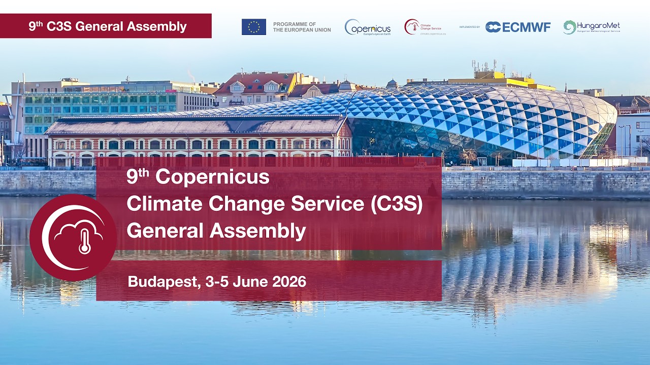
Website :
https://climate.copernicus.eu/9th-c3s-general-assembly
Survey:
https://adriacongrex.online/c3s-ga-3-5-june-2026-budapest-satisfaction-survey/

Website :
https://climate.copernicus.eu/9th-c3s-general-assembly
Survey:
https://adriacongrex.online/c3s-ga-3-5-june-2026-budapest-satisfaction-survey
Module 4 Lecture 3 Information Extraction with High Resolution Optical Satellite Imagery
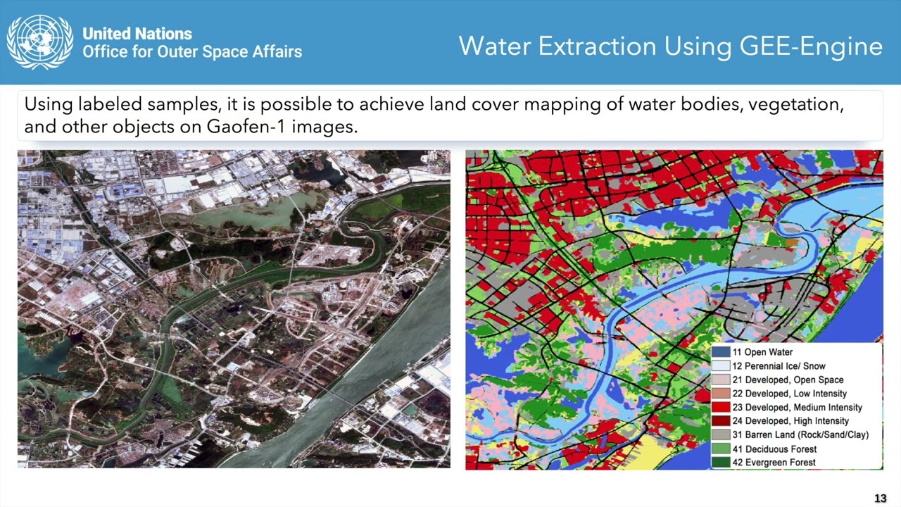
This video is part of the free online course Earth Observation for Sustainable Development: Harnessing the Power of Chinese Satellites — jointly developed by Wuhan University, UNU-INWEH, UN-SPIDER ...
Module 4 Lecture 2 Chinese Optical Remote Sensing Data Access and Licensing
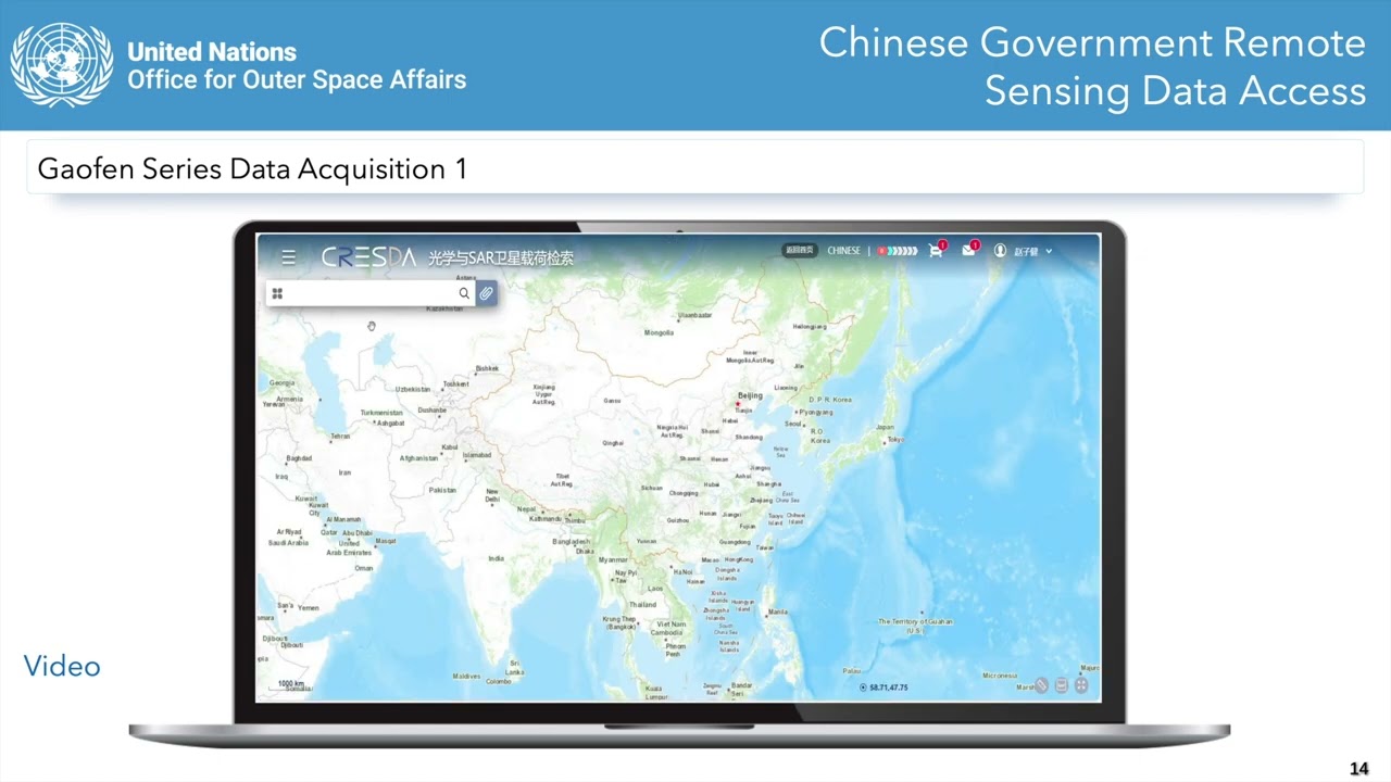
This video is part of the free online course Earth Observation for Sustainable Development: Harnessing the Power of Chinese Satellites — jointly developed by Wuhan University, UNU-INWEH, UN-SPIDER ...
Module 5 Lecture 1 Luojia Series Remote Sensing Satellite
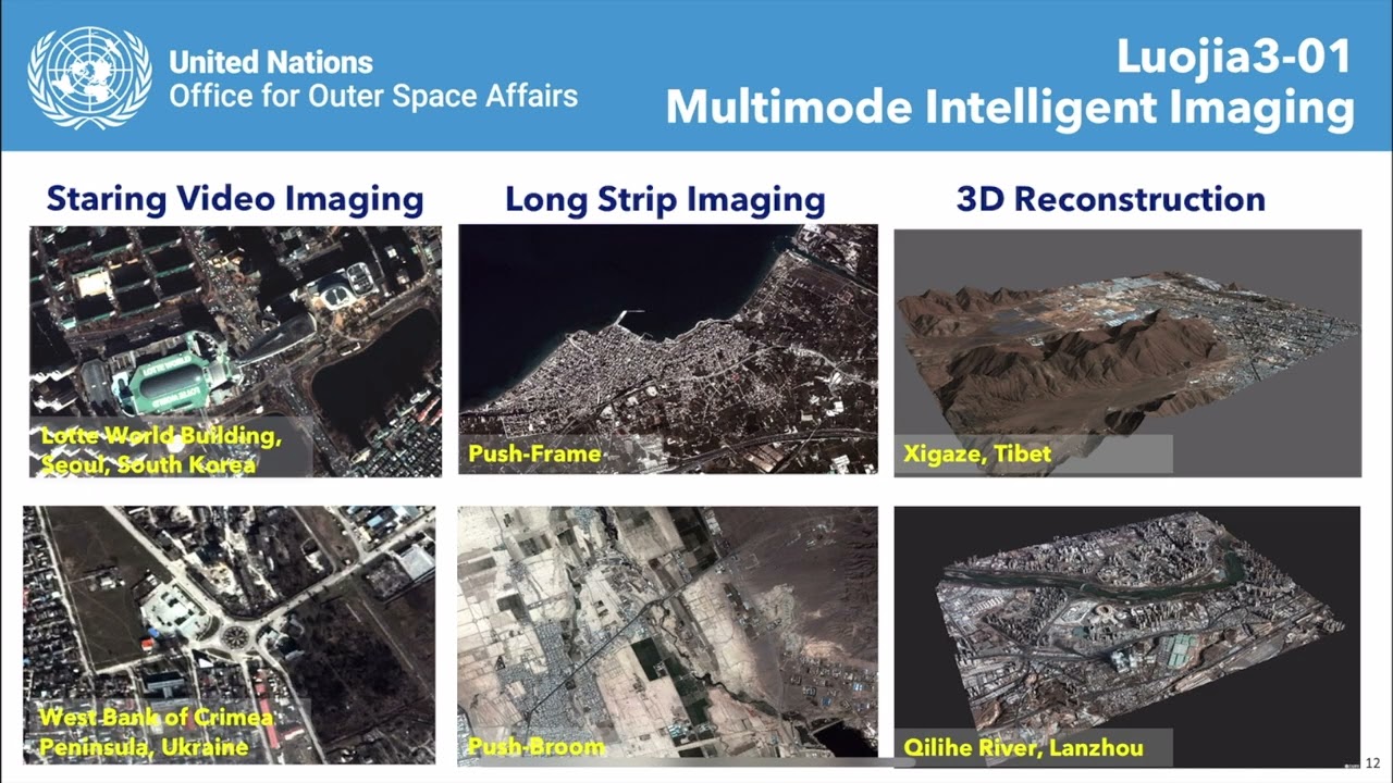
This video is part of the free online course Earth Observation for Sustainable Development: Harnessing the Power of Chinese Satellites — jointly developed by Wuhan University, UNU-INWEH, UN-SPIDER ...
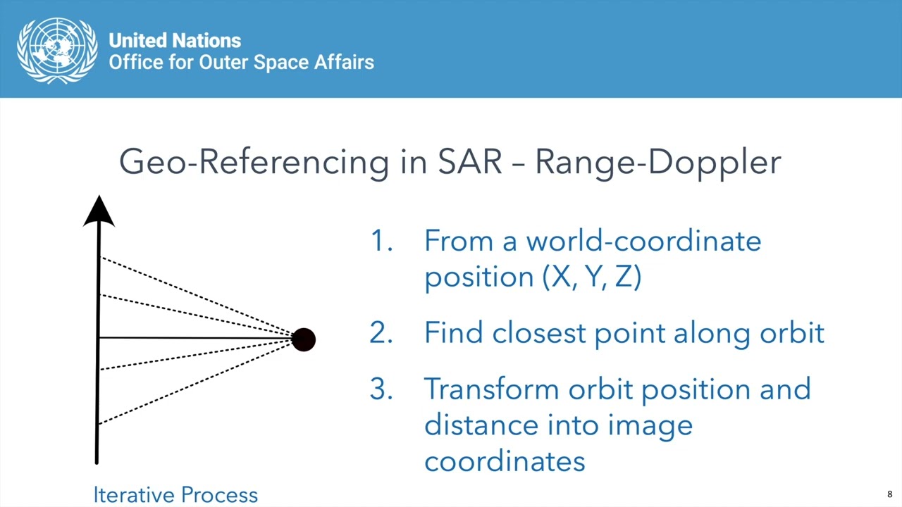
Module 1 Lecture 2 Using Chinese SAR Satellites for Interferometry
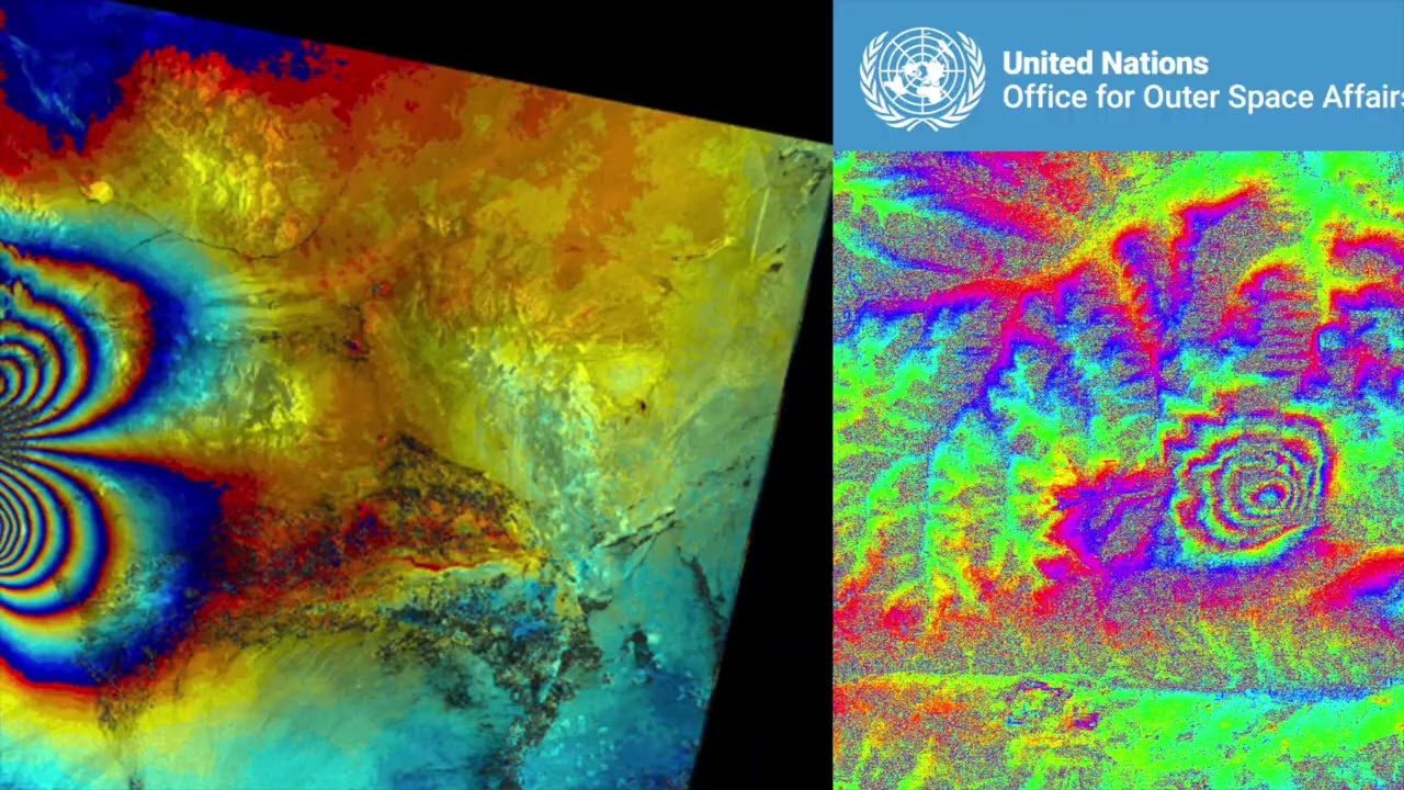
This video is part of the free online course Earth Observation for Sustainable Development: Harnessing the Power of Chinese Satellites — jointly developed by Wuhan University, UNU-INWEH, UN-SPIDER ...
Module 4 Lesson 1 Introduction to High Resolution Optical Remote Sensing Satellite
This video is part of the free online course Earth Observation for Sustainable Development: Harnessing the Power of Chinese Satellites — jointly developed by Wuhan University, UNU-INWEH, UN-SPIDER ...
Module 5 Lecture 4 Hyperspectral Applications of Qimingxing 1 and Luojia 4A

This video is part of the free online course Earth Observation for Sustainable Development: Harnessing the Power of Chinese Satellites — jointly developed by Wuhan University, UNU-INWEH, UN-SPIDER ...
Module 1 Lecture 1 Introduction to Chinese Radar Remote Sensing Satellites
This video is part of the free online course Earth Observation for Sustainable Development: Harnessing the Power of Chinese Satellites — jointly developed by Wuhan University, UNU-INWEH, UN-SPIDER ...
Module 1 Lecture 4 Information Extraction Using Chinese Radar Images
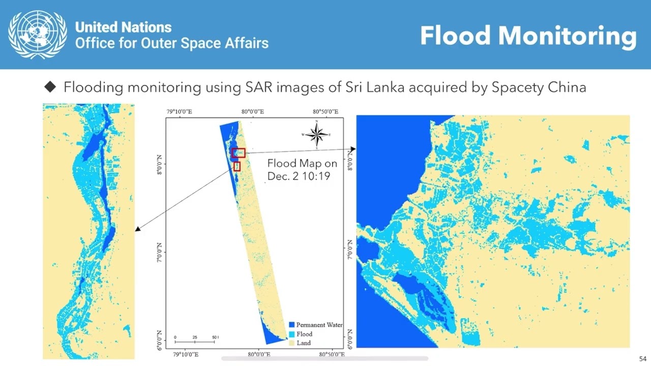
This video is part of the free online course Earth Observation for Sustainable Development: Harnessing the Power of Chinese Satellites — jointly developed by Wuhan University, UNU-INWEH, UN-SPIDER ...
Module 1 Lecture 3 The Calibration andValidation on Chinese SAR Satellites
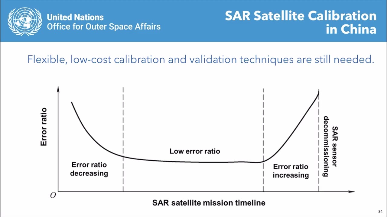
This video is part of the free online course Earth Observation for Sustainable Development: Harnessing the Power of Chinese Satellites — jointly developed by Wuhan University, UNU-INWEH, UN-SPIDER ...
Module 4 Lecture 4 Post Disaster Damage Assessment with High Resolution Optical Satellite Imagery
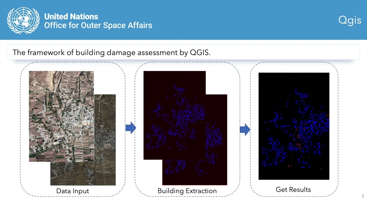
This video is part of the free online course Earth Observation for Sustainable Development: Harnessing the Power of Chinese Satellites — jointly developed by Wuhan University, UNU-INWEH, UN-SPIDER ...

...servations and provides posterior net and gross carbon fluxes from assimilating remotely sensed FAPAR, SIF, L-VOD and surface layer SM.