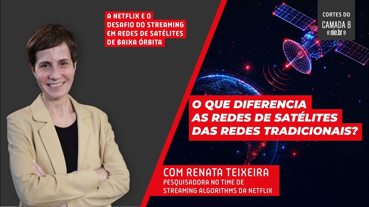
Neste corte do Camada 8, Renata Teixeira, pesquisadora do time de Streaming Algorithms da Netflix, explica como a troca constante de satélites nas redes LEO influencia diretamente a latência, a qua...
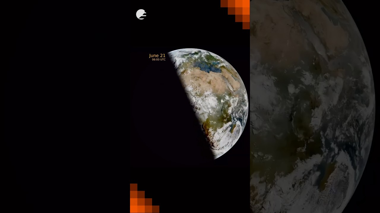
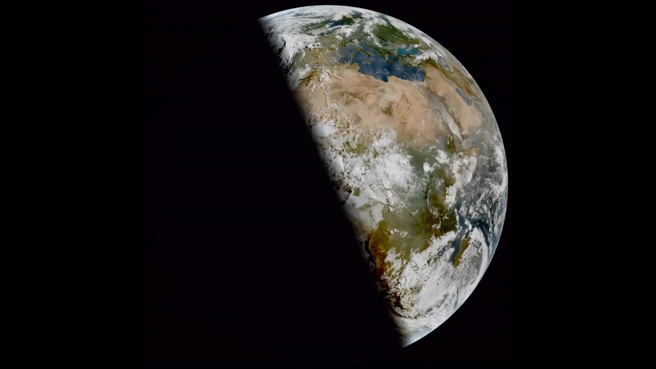
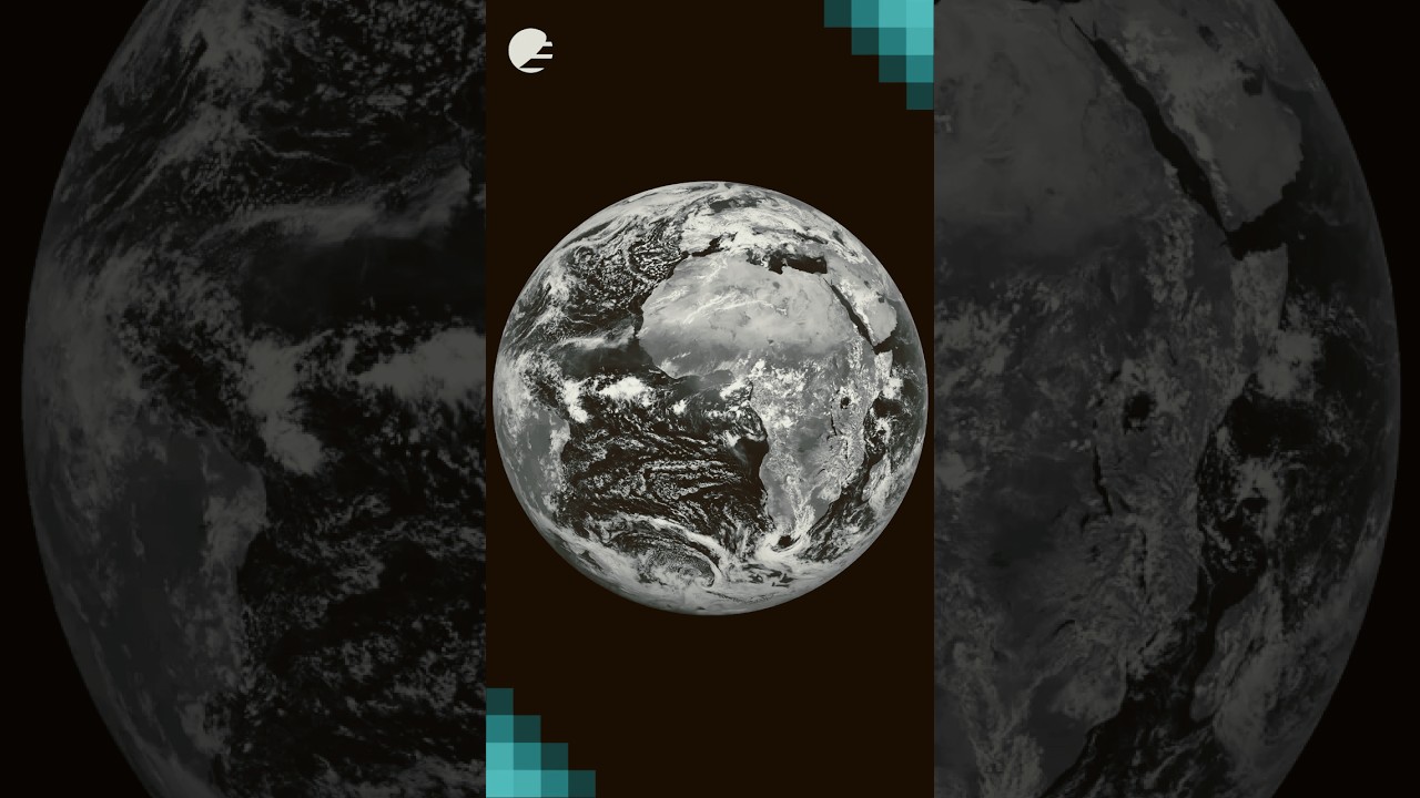
This animation shows daily snapshots at 06:00 UTC from Meteosat-12’s Flexible Combined Imager, tracking the terminator (the line between day and night) as it swings from the December solstice, thro...
Watch our making-of and the effort that went into capturing this special moment. 👀
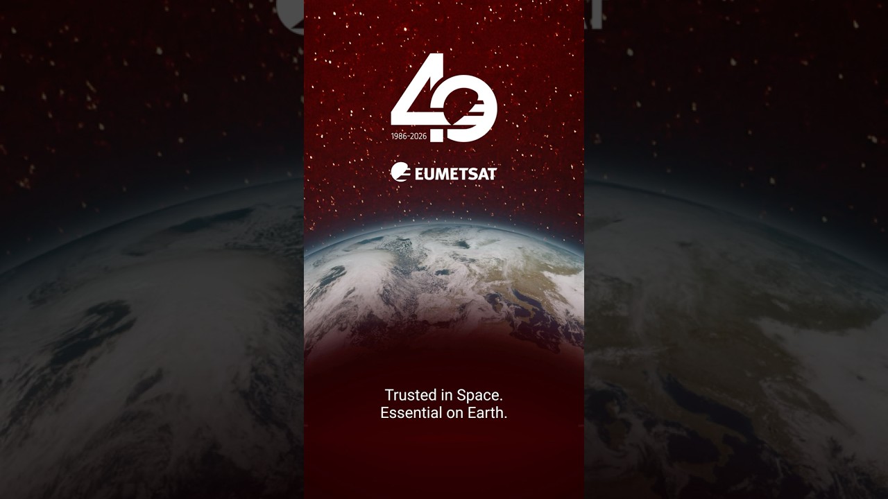
On Friday we marked 40 years of serving our Member States and the planet. 🛰
Here’s to the people behind the data.
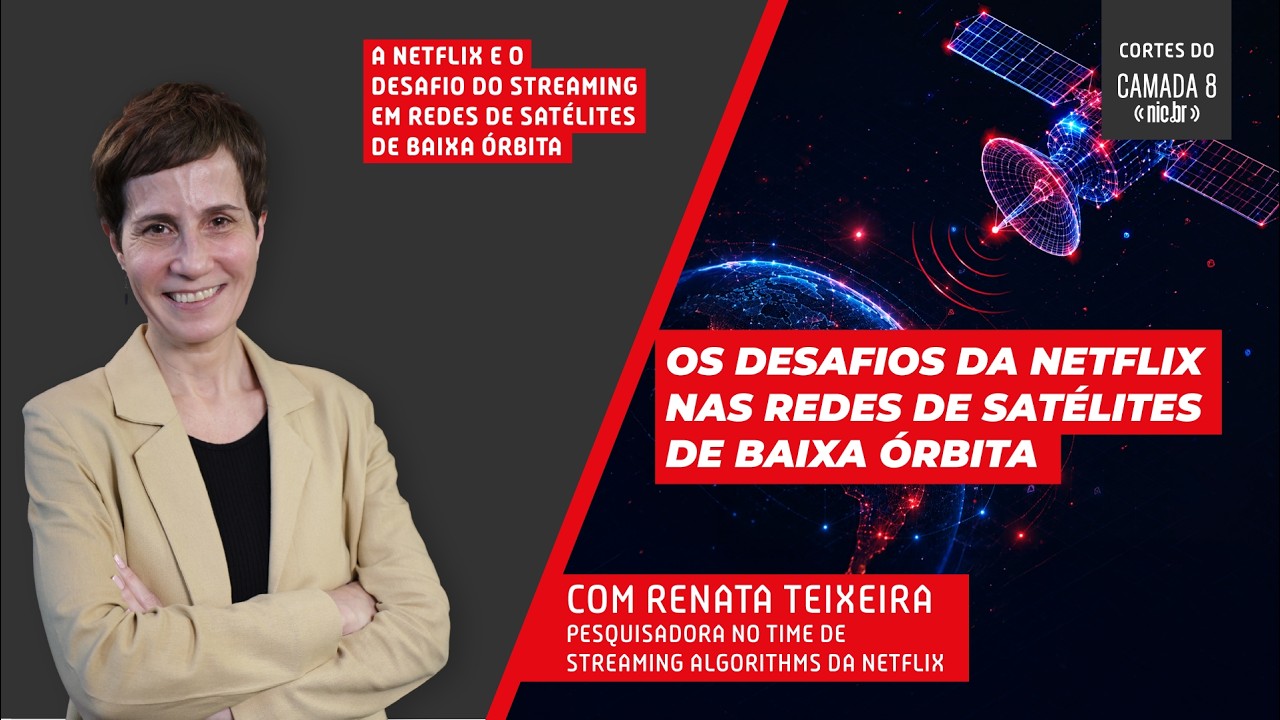
Neste episódio do Camada 8, Renata Teixeira, pesquisadora do time de Streaming Algorithms da Netflix, explica como funcionam as conexões via satélites de órbita baixa (LEO), como a Starlink, e os d...
Yesterday, 08:24 UTC (10:24 CEST) marked the June solstice - the longest day of the year in the Northern Hemisphere, and the moment Earth’s tilt points us most directly at the sun. ☀️
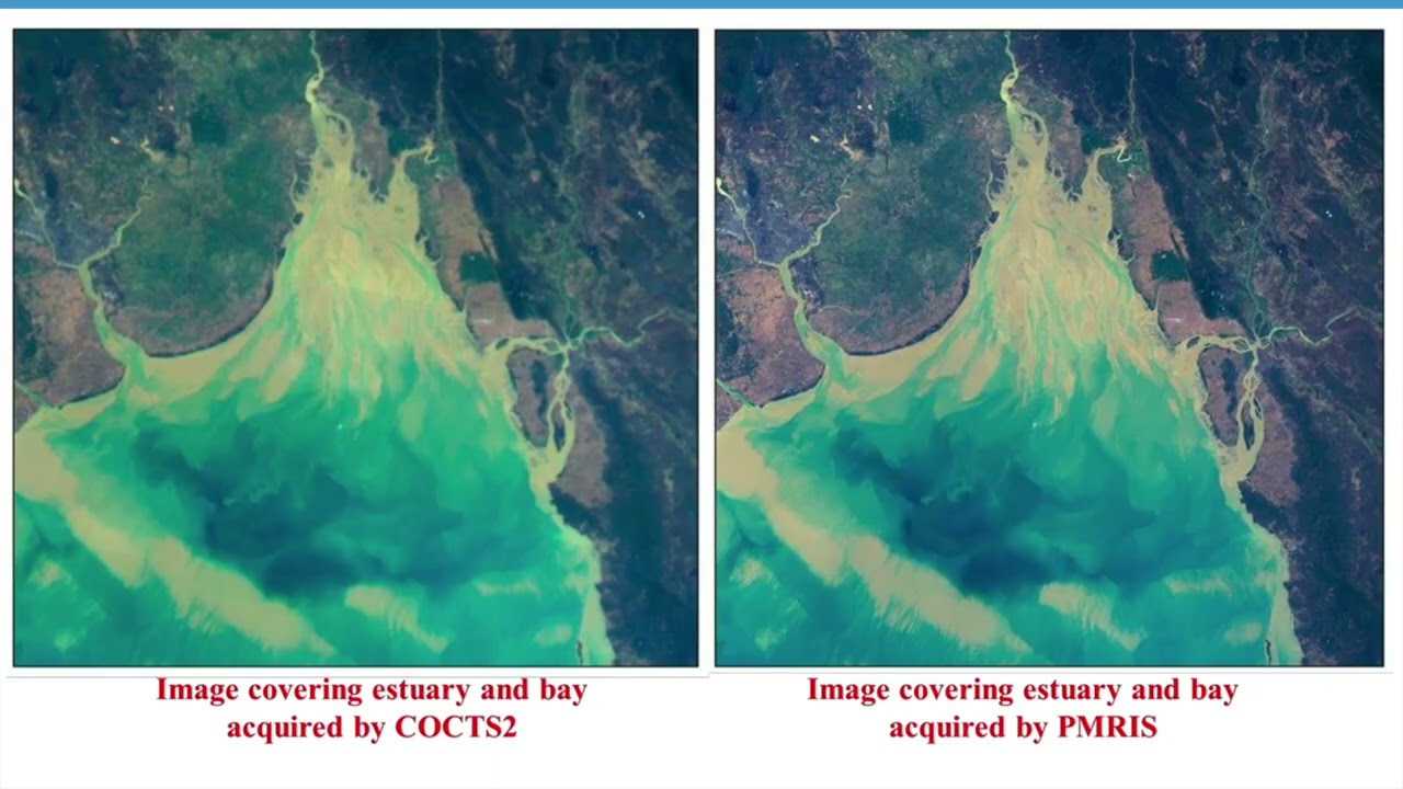
From geosta...
Module 3 Lecture 1: Introduction to HaiYang Satellites
Online course Earth Observation for Sustainable Development
This video is part of the free online course Earth Observation for Sustainable Development: Harnessing the Power of Chinese Satellites —...
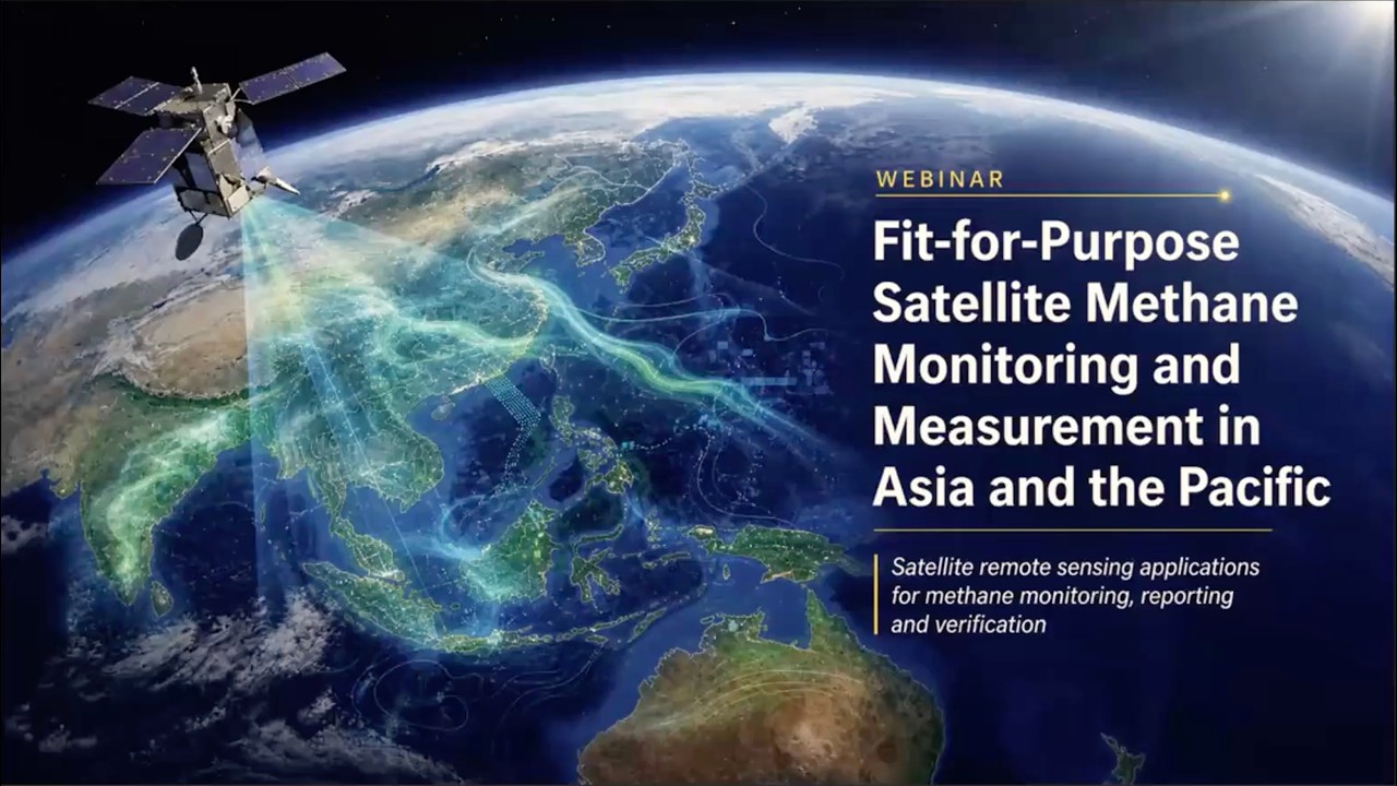
The webinar, co-organized by the United Nations Economic and Social Commission for Asia and the Pacific (ESCAP) and the Environmental Defense Fund (EDF), provided policymakers, civil society and in...
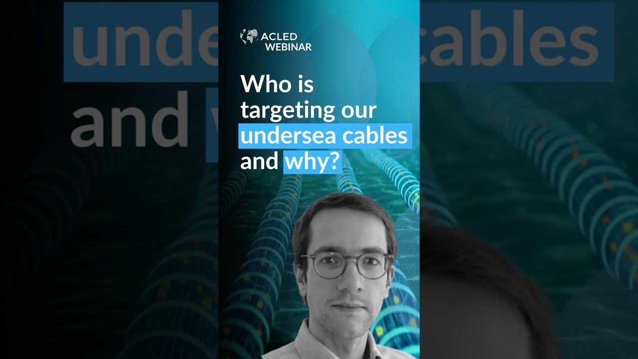
#underseacables carry roughly 99% of global internet traffic — enabling everything from digital payments to video calls and online shopping.
In our latest webinar, Mathieu Boulègue explained why t...
Module 5 Lecture 3 Applications of Luojia 3 Satellites
This video is part of the free online course Earth Observation for Sustainable Development: Harnessing the Power of Chinese Satellites — jointly developed by Wuhan University, UNU-INWEH, UN-SPIDER ...
Module 2 Lecture 1 Overview of Fengyun Meteorological Satellites

This video is part of the free online course Earth Observation for Sustainable Development: Harnessing the Power of Chinese Satellites — jointly developed by Wuhan University, UNU-INWEH, UN-SPIDER ...
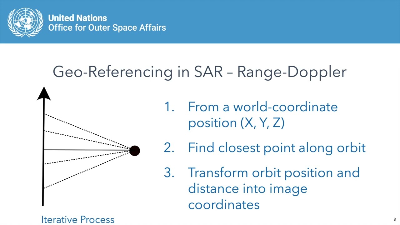
Module 1 Lecture 2 Using Chinese SAR Satellites for Interferometry
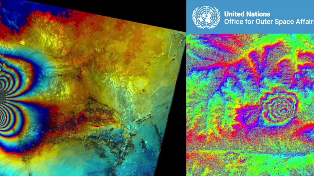
This video is part of the free online course Earth Observation for Sustainable Development: Harnessing the Power of Chinese Satellites — jointly developed by Wuhan University, UNU-INWEH, UN-SPIDER ...
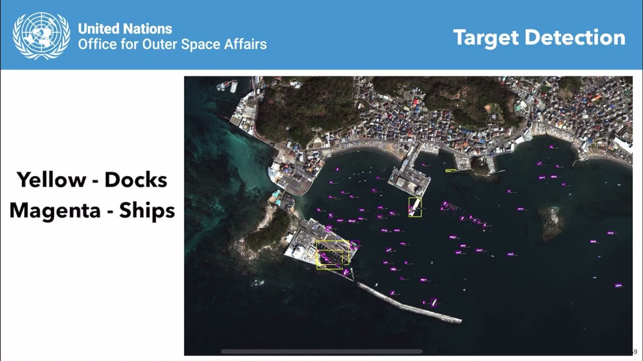
Module 4 Lesson 1 Introduction to High Resolution Optical Remote Sensing Satellite
This video is part of the free online course Earth Observation for Sustainable Development: Harnessing the Power of Chinese Satellites — jointly developed by Wuhan University, UNU-INWEH, UN-SPIDER ...
Module 1 Lecture 1 Introduction to Chinese Radar Remote Sensing Satellites
This video is part of the free online course Earth Observation for Sustainable Development: Harnessing the Power of Chinese Satellites — jointly developed by Wuhan University, UNU-INWEH, UN-SPIDER ...
Module 1 Lecture 3 The Calibration andValidation on Chinese SAR Satellites
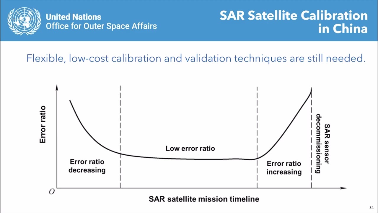
This video is part of the free online course Earth Observation for Sustainable Development: Harnessing the Power of Chinese Satellites — jointly developed by Wuhan University, UNU-INWEH, UN-SPIDER ...
Module 4 Lecture 4 Post Disaster Damage Assessment with High Resolution Optical Satellite Imagery
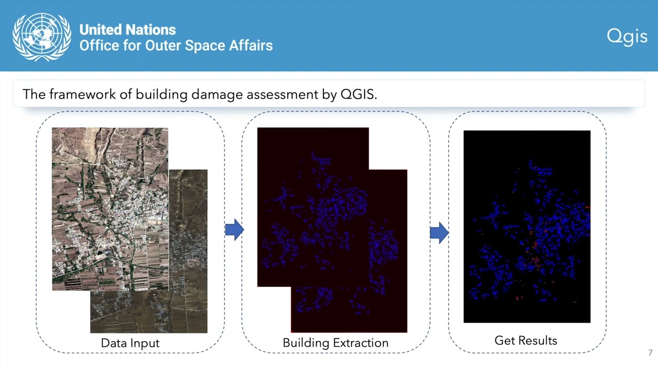
This video is part of the free online course Earth Observation for Sustainable Development: Harnessing the Power of Chinese Satellites — jointly developed by Wuhan University, UNU-INWEH, UN-SPIDER ...
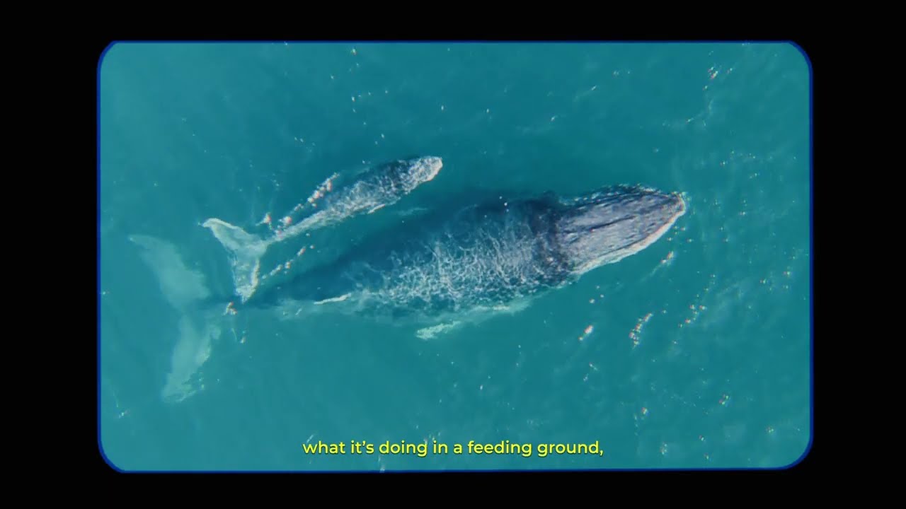
Tuta, Wallina y Encanto ya están ayudándonos a revelar los secretos del océano. 🐋📡
Gracias al marcaje satelital, hoy podemos seguir sus rutas migratorias, conocer las zonas que utilizan y generar .
21 April 2026 (Day 1) | New endorsed projects - lightning talks:
- Marine Spatial Planning Addressing Climate Effects (MSPACE)
Matt Frost, Plymouth Marine Laboratory
- Monitoring CECs impacts in ...
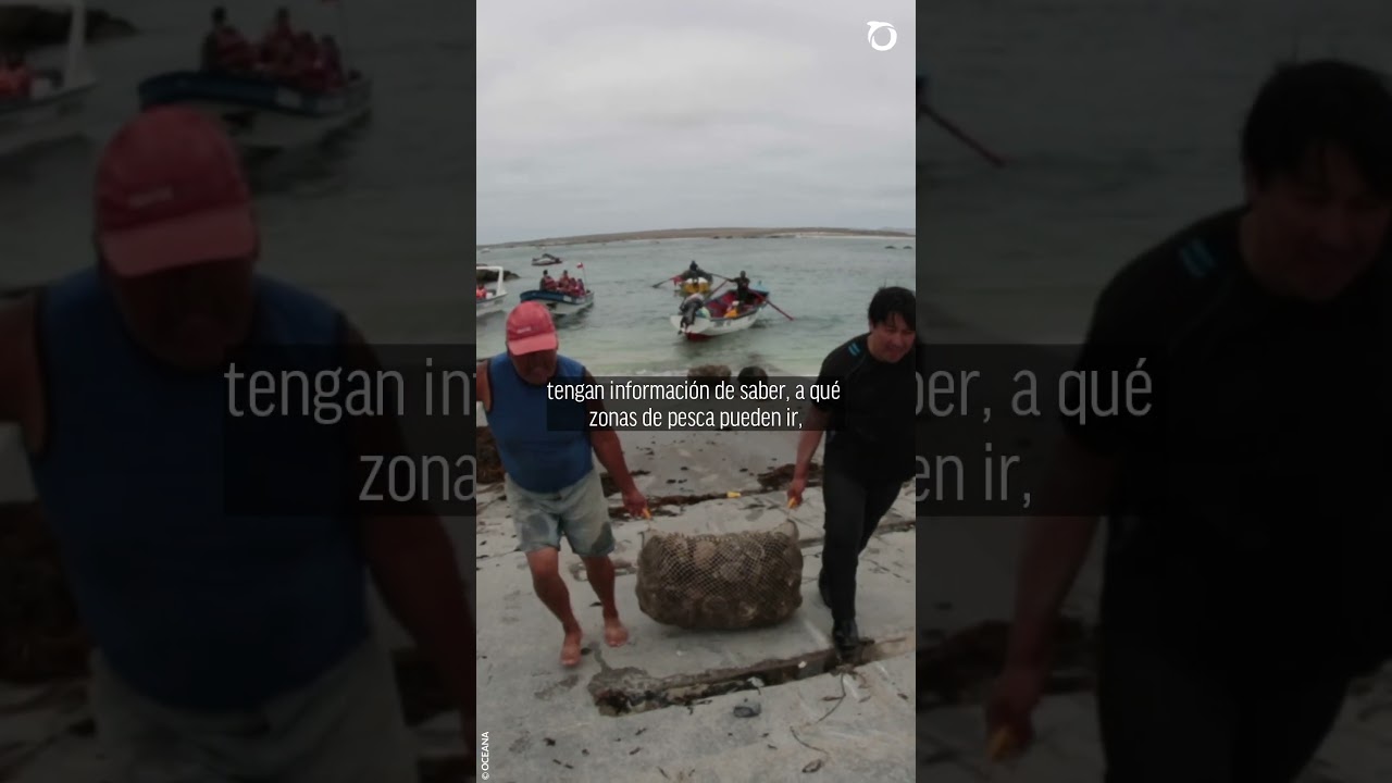
En este #MesDelMar, César Astete, Director de Pesquerías de Oceana en Chile, conversó con Cooperativa Ciencia sobre la importancia de la trazabilidad.
Implementar sistemas de posicionamiento en to...
Over our 40-year history, Meteosat – Europe’s geostationary weather satellite series – have been the go-to source for imagery of the entire Earth disc over Europe and Africa. One of our first respo...