 European Forest Institute
2d ago
European Forest Institute
2d ago
▶
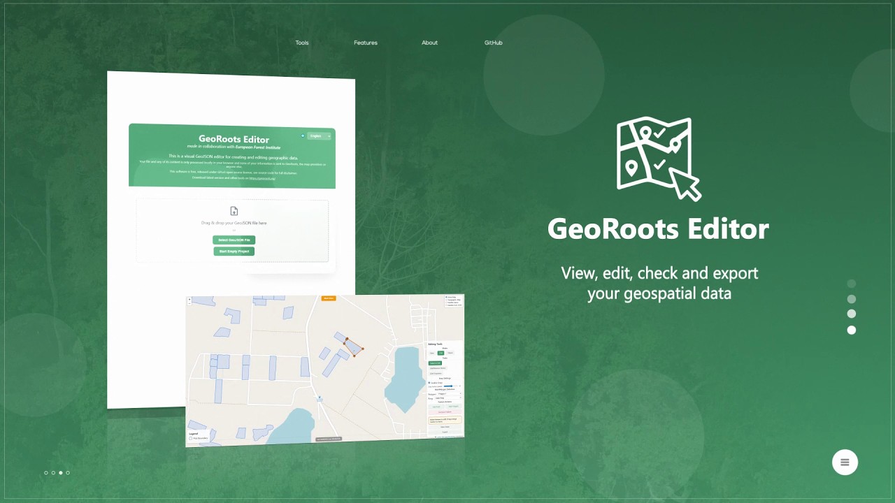
GeoRoots Editor 01
GeoRoots Editor is an interface that allows for visual inspection on satellite maps, automated quality control, and manual editing of plots: correcting boundaries, points, etc.
In the first part of of the GeoRoots Editor, we cover the initial steps of the workflow: how to load geolocation data into the editor, how to use the "View Mode" to overlay polygons onto satellite and topographic maps, and how to run the automated "Check Mode" (Quality Control) to identify structural errors, overlapping boundaries, or missing properties that would cause an EUDR submission to fail.