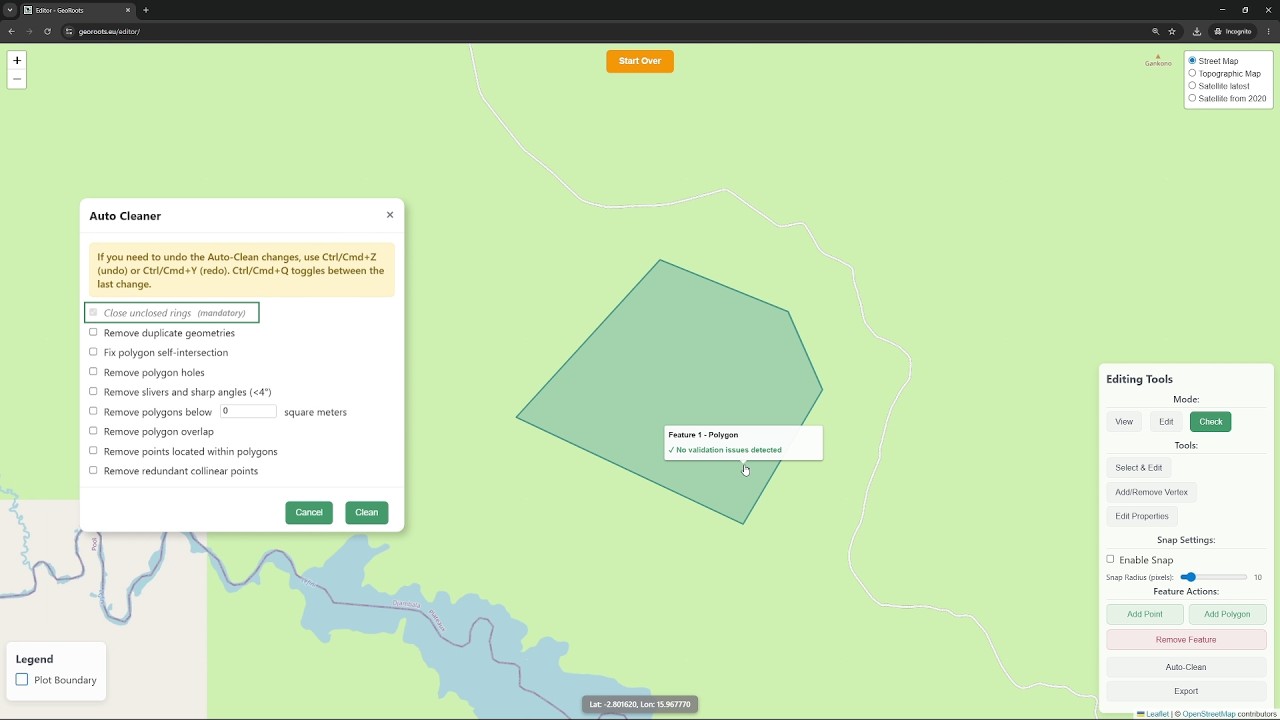
In the second video, we focus on the "Edit Mode" and the resolution of errors. We provide an step by step to manually fix the issues found during the quality control check, like adjusting polygon n...
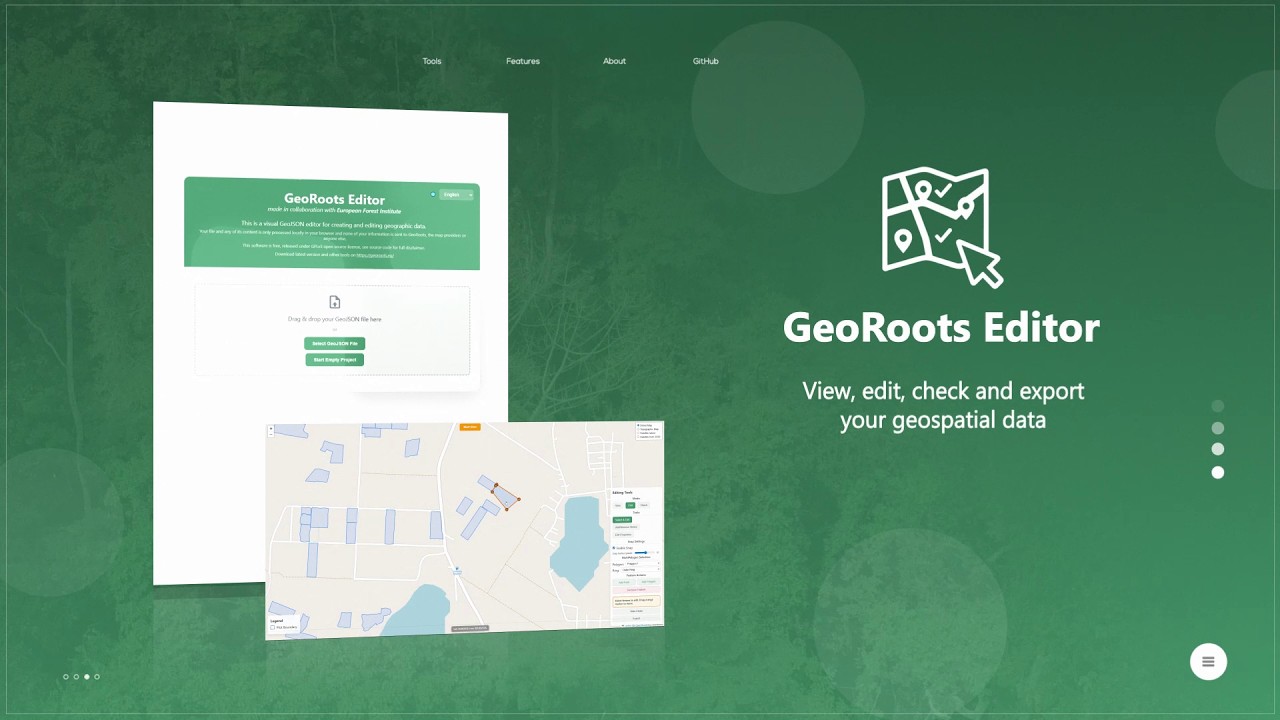
GeoRoots Editor is an interface that allows for visual inspection on satellite maps, automated quality control, and manual editing of plots: correcting boundaries, points, etc.
In the first part o...
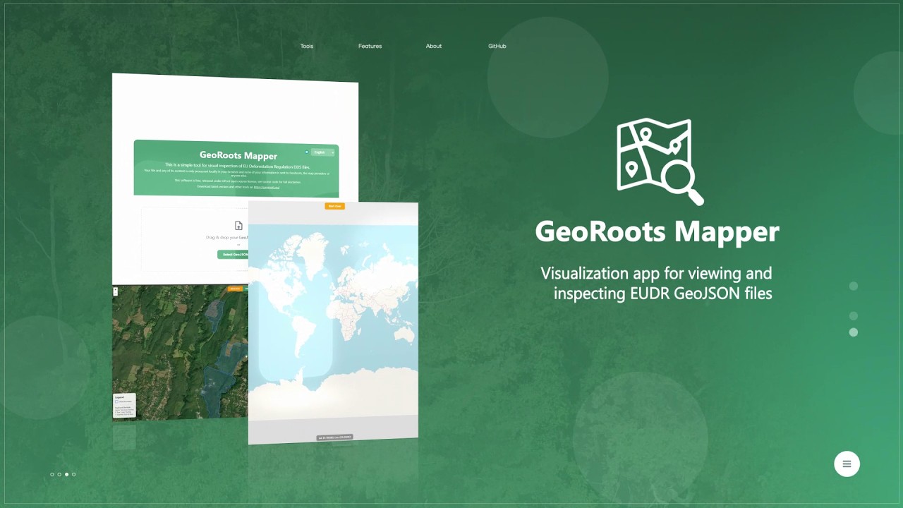
GeoRoots Mapper is a tool for the rapid visualization of GeoJSON files. This video shows how to use the GeoRoots Mapper to quickly load and visualise GeoJSON files (polygons or GPS points) on a map...
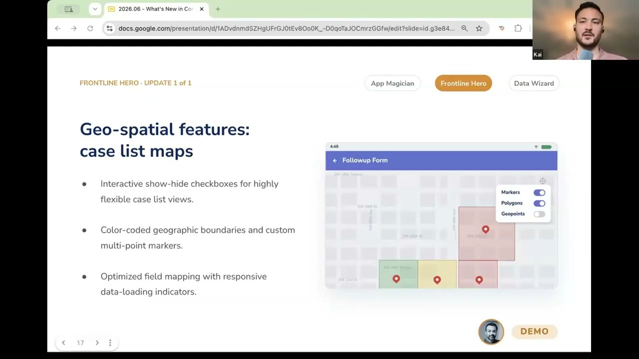
In this video, you get a demo of CommCare's geospatial feature upgrades that turn a frontline worker's case list into an interactive map. Instead of seeing a list of names, they can see their cases...
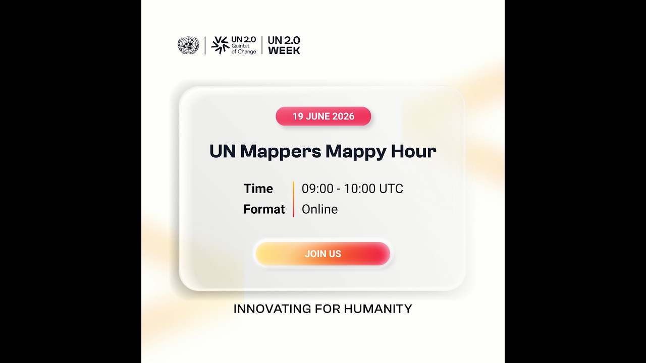
...as our volunteers and contributors joined the a virtual exchange and an hour of mapping together through the UN Mappers Mappy Hour.
UN Mappers Mappy Hour is an online hangout ...
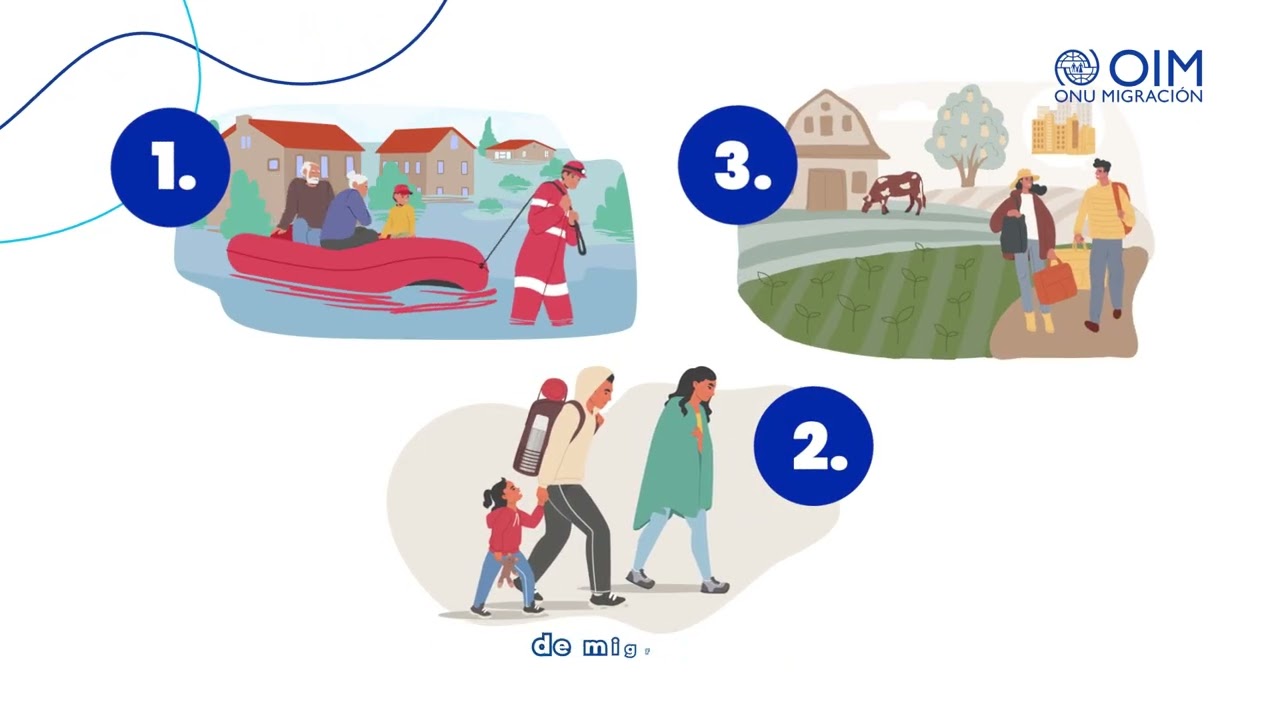
📉 La Matriz de Seguimiento de Desplazamiento (DTM) transforma datos en respuestas humanitarias.
Descubre como funciona en el siguiente #short

How can local communities affected by disasters report damage quickly and effectively?
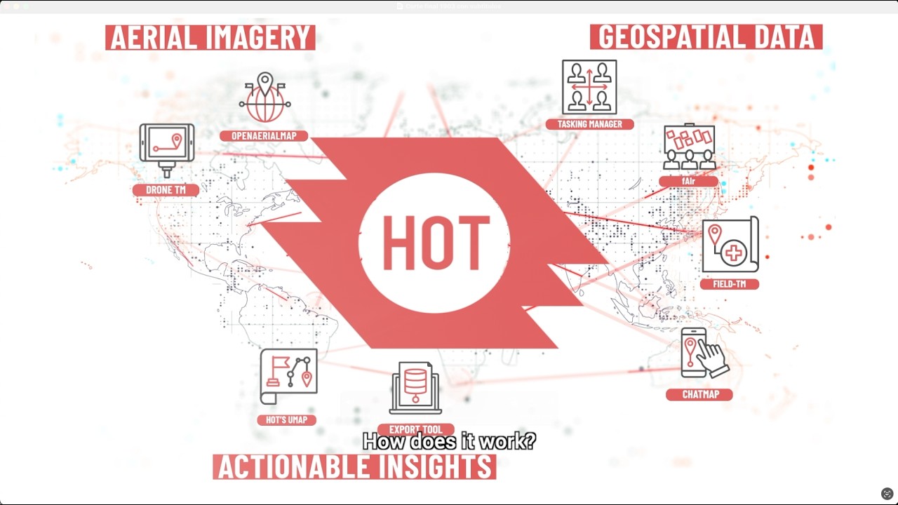
ChatMap transforms messages into maps, enabling crisis-affected communities to report damage in real time usi...
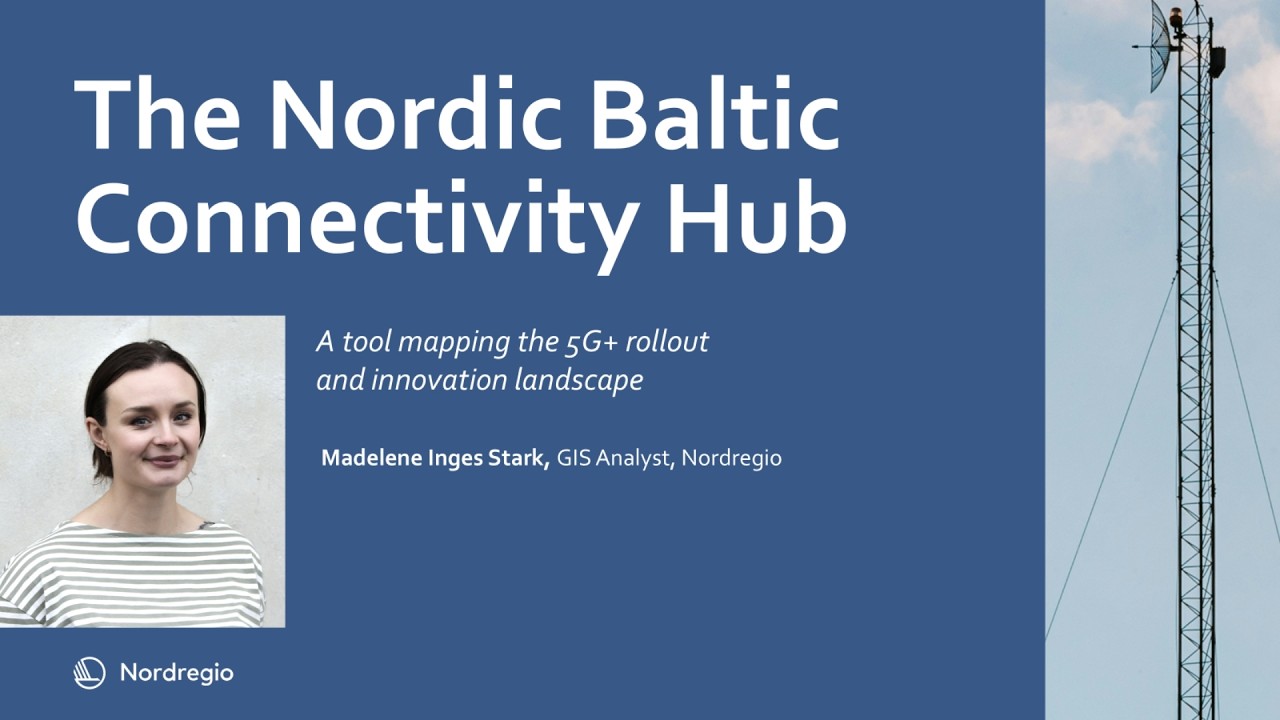
...per at Nordregio as she explores the Nordic-Baltic Connectivity Hub: A tool for mapping and connecting the region
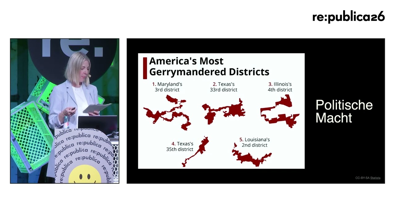
Mapping ist Macht: Wie Karten als Werkzeuge der Kontrolle dienen
„Mapping the Future“, „Mapping...
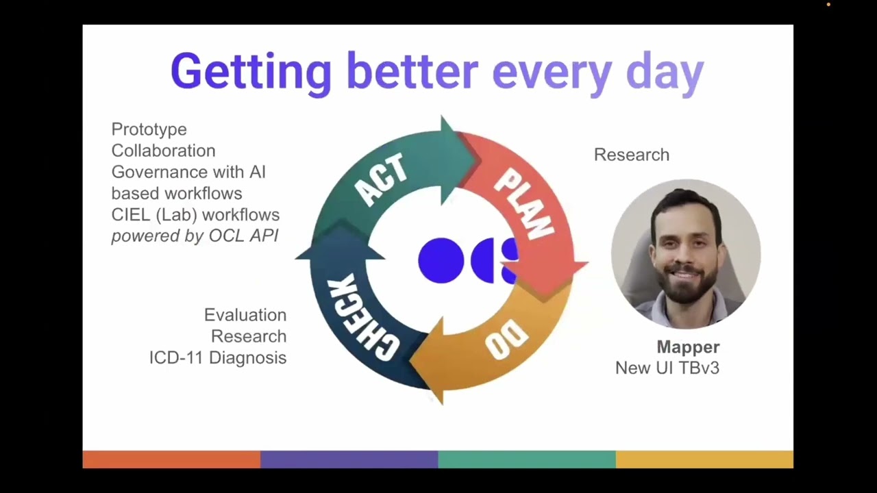
...OCL Mapper, a new tool that helps you enrich your OpenMRS concept dictionary by mapping it to ICD-10, ICD-11, SNOMED CT, and other standard terminologies, with AI-generated can...

O convidado de abril do Camada 8 é André Ricardo Landim, Analista de Segurança no CAIS/RNP.
Neste vídeo, André fala do potencial e das aplicações práticas do Maltego, uma ferramenta de código aber...

The 2026 Mazda CX-5 is equipped with Google Built-In, but it's only free for a year. Catch the full conversation: https://youtu.be/gYRzZjfMstg/?EXTKEY=YSOCIAL_YT

Watch a live walkthrough of the Terminology Server's Concept Maps feature — enter ICD-10 code E11 and see it resolve to validated equivalents in SNOMED CT, MedDRA LLT, UMLS, and other target system...

This short video introduces the IDB-3ie Transportation EGM Navigator (beta version). The AI-powered Navigator can help you navigate and query the EGM more efficiently using natural-language questio...
How to download a layer in the GGMN & GGIS?
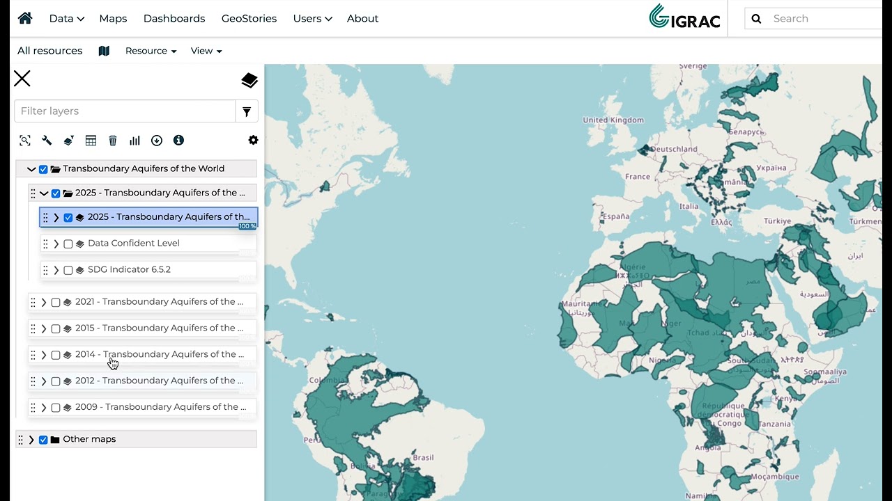
In this tutorial, we will walk you through all the steps to download a layer IGRAC's GGMN (Global Groundwater Monitoring Network) & GGIS (Global Groundwater Information System).
We will expla...
Lecture 19: Spatial Visualization II: Advanced Contour & Vector Plotting
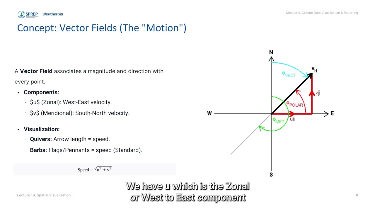
Equips participants with Open Source tools to create advanced spatial maps, aiming to enhance national sovereignty over climate insights.
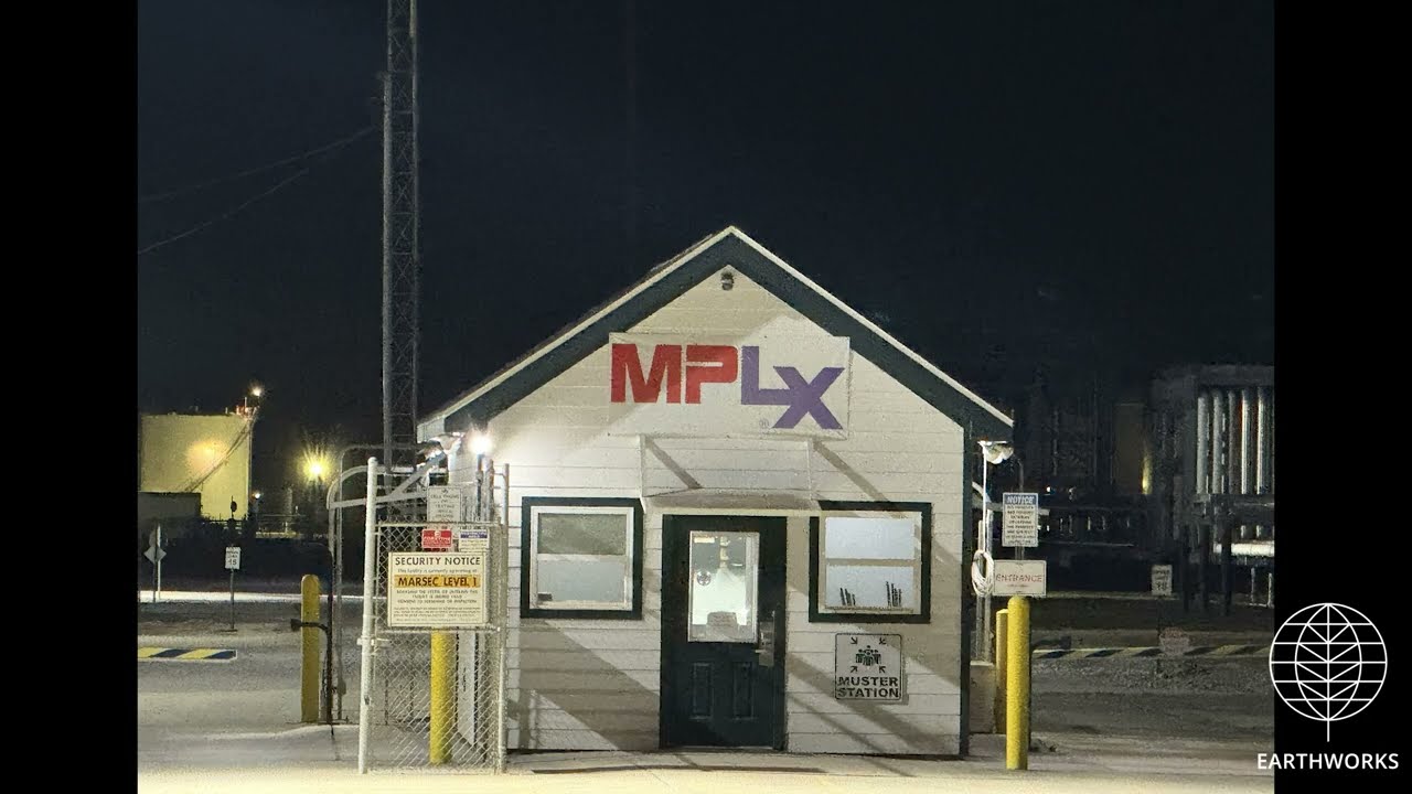
MPLX - Mount Airy
Mount Airy, St. John the Baptist Parish, LA
(30.05378, -90.64382)
Filmed 11/13/2025