▶
Why Africa Looks Different on Different Maps
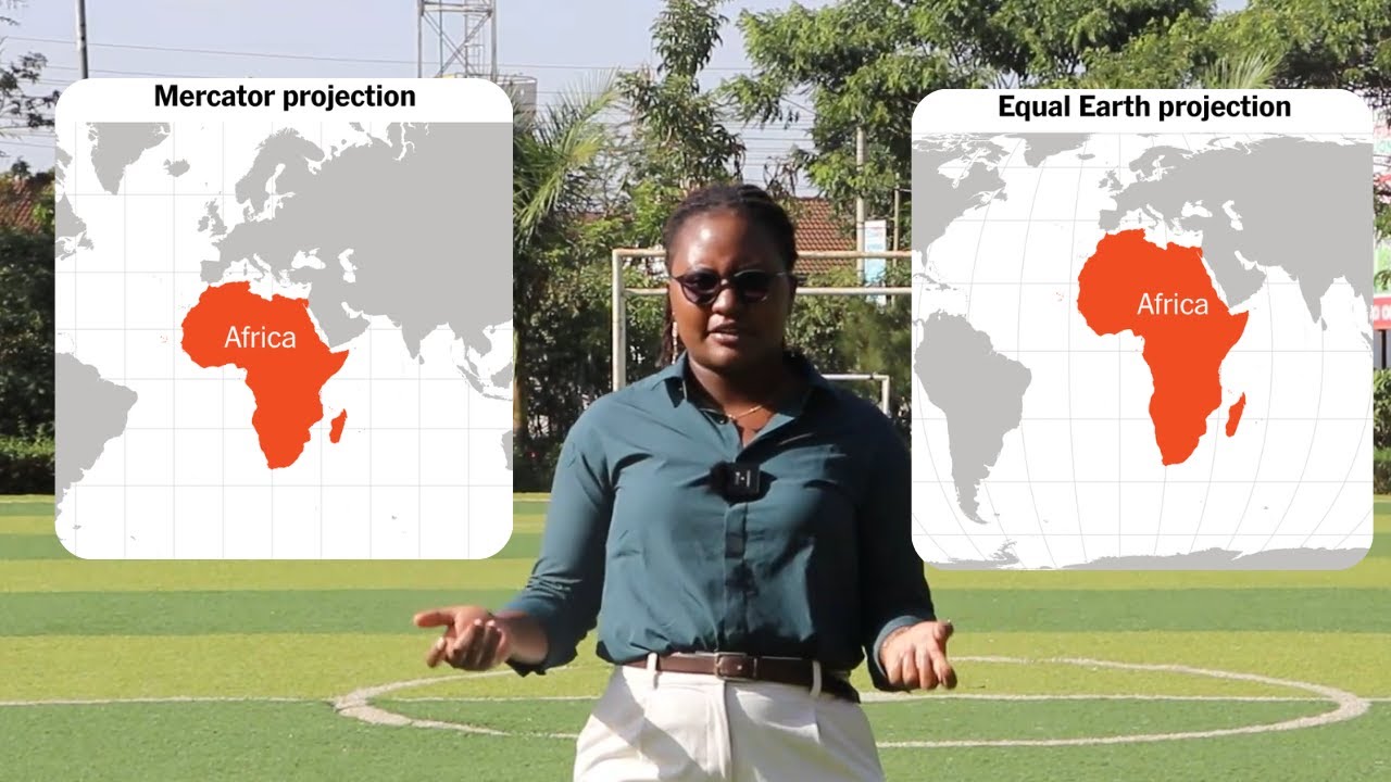
This video explains how map projections and coordinate systems change the way the world is drawn and why the Mercator projection, used in most maps today, makes countries near the equator appear smaller. #MapProjection #Africa #GIS #Cartography #CorrectTheMap #Geography #DataVisualization #Geospatial #MapsMatter