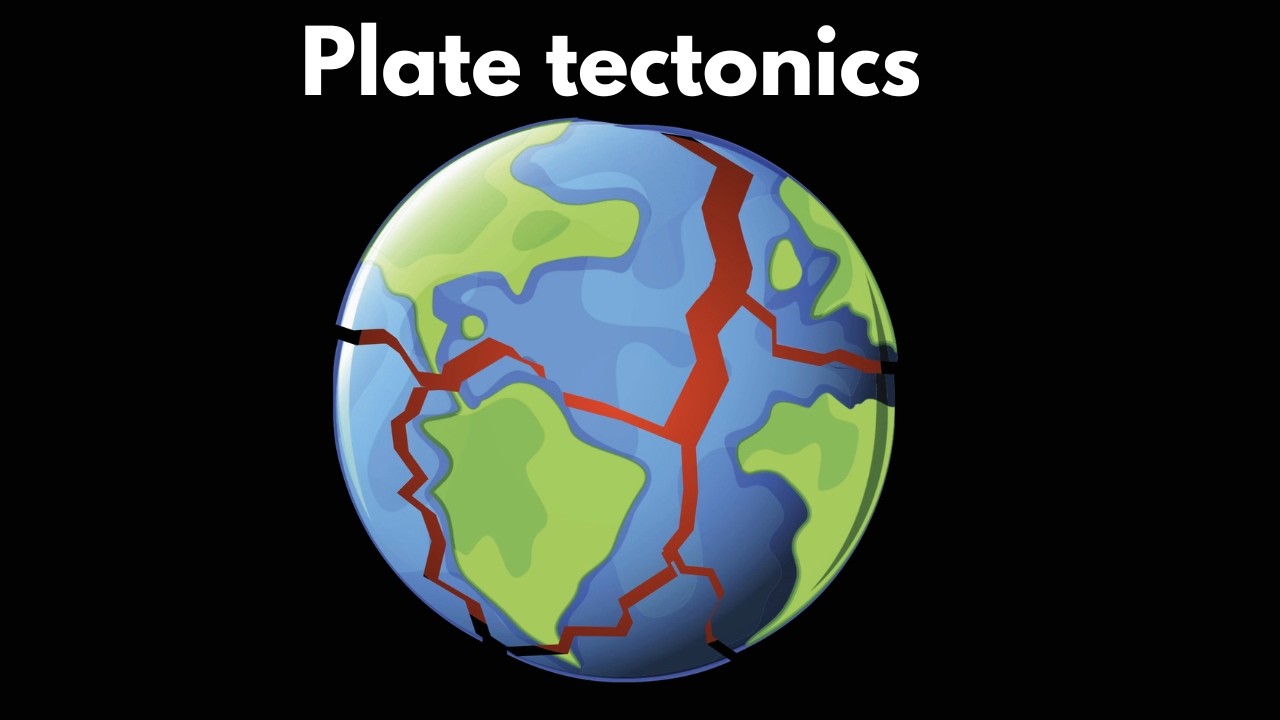
...here is plastic, and moves the upper plates on convection currents of heat from Earth’s interior.
Next Generation Science Standards (NGSS):MS-ESS2-2, MS-ESS2-3, MS-ESS2.A.2...
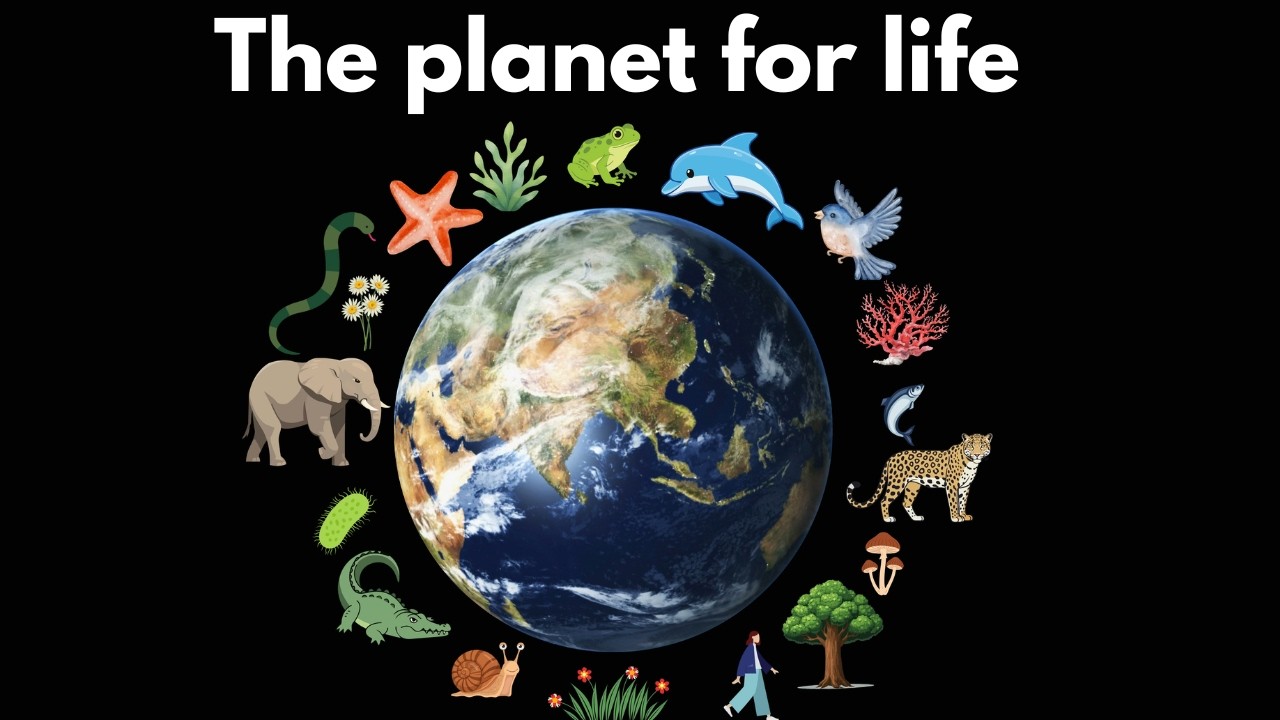
Earth is the perfect planet for life as we know it! It orbits the Sun in the habitable zone, w...
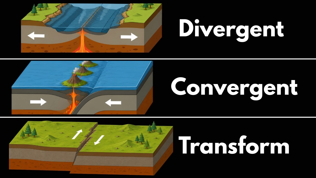
...te, creating a subduction zone. These regions are known for mountain formation, earthquakes, and volcanoes. Transform boundaries occur when plates slide alongside each other....

...ing-ready datasets.
This video is part of ECMWF's course "Machine Learning for Earth Systems Modelling: Architectures, Data, and Prediction", part of the Destination Earth (...
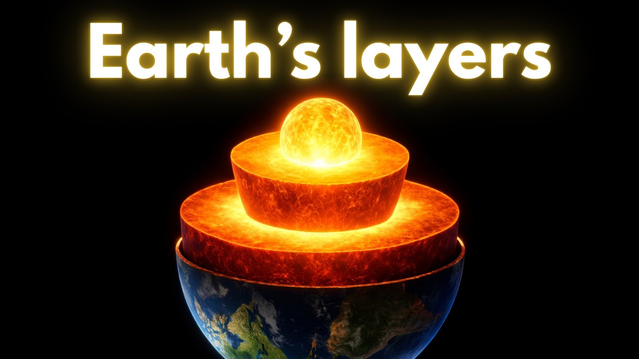
Much like a peach, Earth is divided into layers. The thinnest layer is the crust, which composes all the continen...
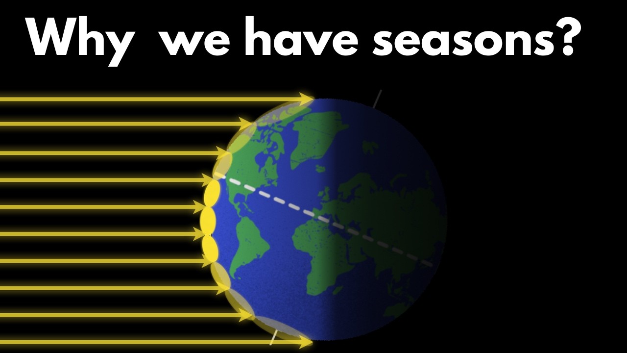
...misconceptions about what causes the seasons. It’s not the changing distance of Earth to the Sun, but Earth’s axial tilt that causes the seasons. When the Northern Hemisphere...

...ing-ready datasets.
This video is part of ECMWF's course "Machine Learning for Earth Systems Modelling: Architectures, Data, and Prediction", part of the Destination Earth (...
Watch our making-of and the effort that went into capturing this special moment. 👀
On Friday we marked 40 years of serving our Member States and the planet. 🛰
Here’s to the people behind the data.
Module 3 Lecture 1: Introduction to HaiYang Satellites
Online course Earth Observation for Sustainable Development
This video is part of the free online course Ea...
Module 4 Lecture 3 Information Extraction with High Resolution Optical Satellite Imagery
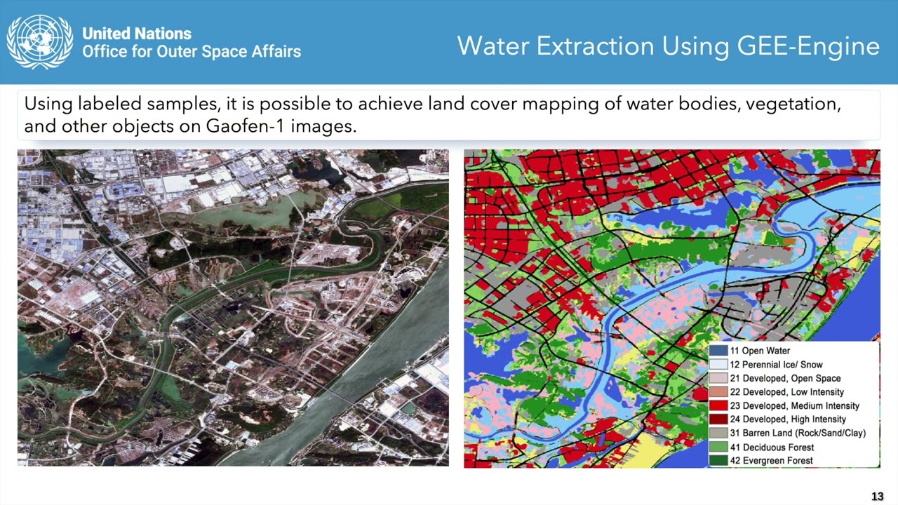
This video is part of the free online course Earth Observation for Sustainable Development: Harnessing the Power of Chinese Satellites — jo...
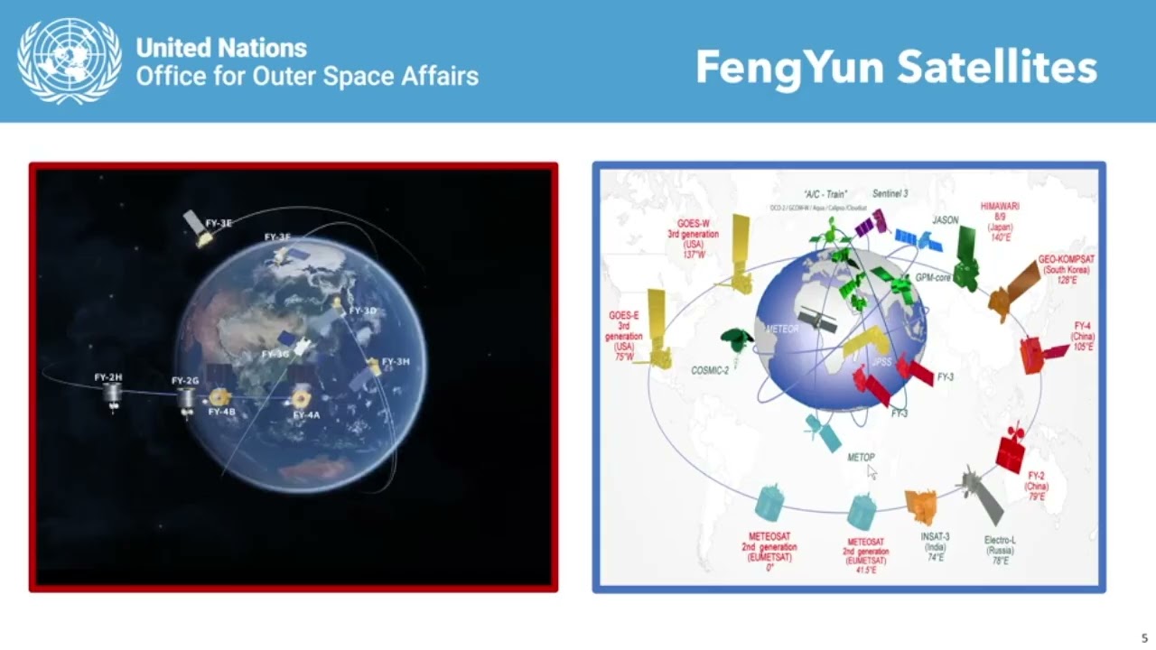
Module 2 Lecture 1 Overview of Fengyun Meteorological Satellites

This video is part of the free online course Earth Observation for Sustainable Development: Harnessing the Power of Chinese Satellites — jo...
Module 5 Lecture 1 Luojia Series Remote Sensing Satellite
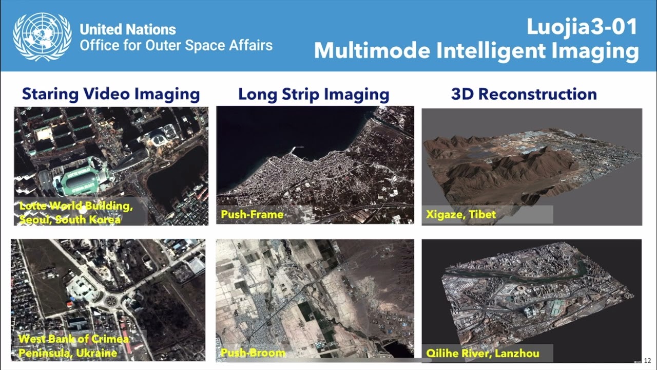
This video is part of the free online course Earth Observation for Sustainable Development: Harnessing the Power of Chinese Satellites — jo...
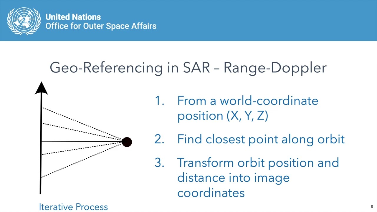
Module 1 Lecture 2 Using Chinese SAR Satellites for Interferometry
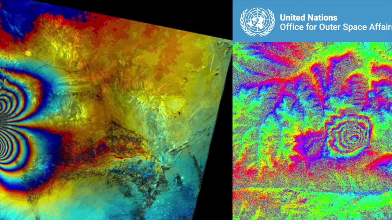
This video is part of the free online course Earth Observation for Sustainable Development: Harnessing the Power of Chinese Satellites — jo...
Module 5 Lecture 2 Data Processing and Information Extraction for Luojia Satellites
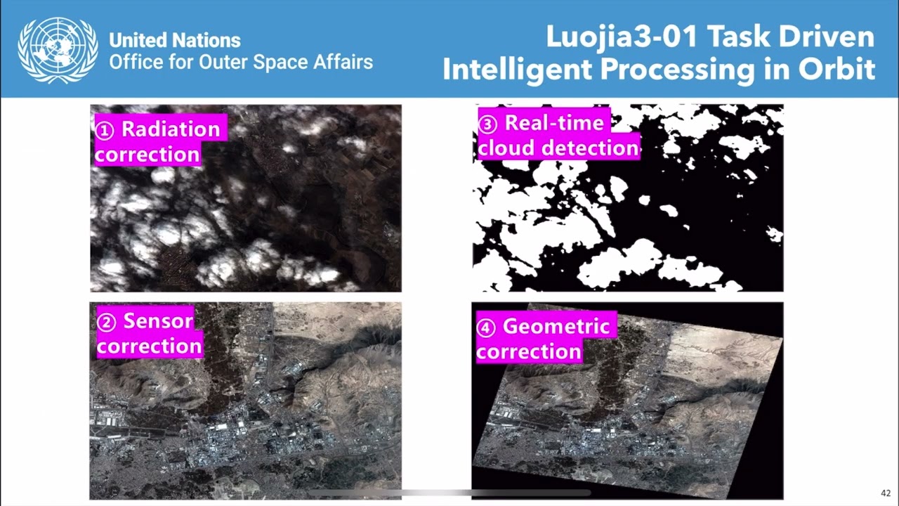
This video is part of the free online course Earth Observation for Sustainable Development: Harnessing the Power of Chinese Satellites — jo...
Module 5 Lecture 4 Hyperspectral Applications of Qimingxing 1 and Luojia 4A

This video is part of the free online course Earth Observation for Sustainable Development: Harnessing the Power of Chinese Satellites — jo...
Module 1 Lecture 1 Introduction to Chinese Radar Remote Sensing Satellites
This video is part of the free online course Earth Observation for Sustainable Development: Harnessing the Power of Chinese Satellites — jo...
Module 1 Lecture 4 Information Extraction Using Chinese Radar Images
This video is part of the free online course Earth Observation for Sustainable Development: Harnessing the Power of Chinese Satellites — jo...
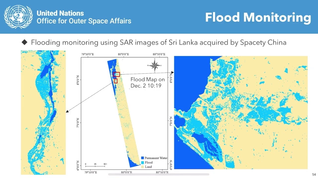
Module 2 Lecture 3: Application of Fengyun Satellite Data in Extreme Weather Monitoring Case Study
This video is part of the free online course Earth Observation for Sustainable Development: Harnessing the Power of Chinese Satellites — jo...
2026 | Visibilizar genera acción - El monitoreo satelital de metano
Volvimos un año más con la sección Encuentros junto a la compostera! Esta temporada consta de 4 espacios virtuales donde nos encontramos cómo si estuviéramos con los pies en la tierra y el viento e...