SEABAS – Solving The Puzzle
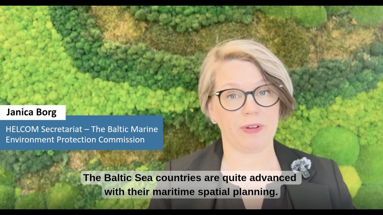
Maritime spatial planning (MSP) has been a key asset for the Baltic Sea countries in making effective use...


Why Are Maps Important? | Insights from Global Mapping Experts | Episode 1

Explore what makes aesthetic, integrated, and inclusive maps so important from global public transport professionals working in mapping.
Maps - like public transport - are a part of every journey ...


Most council’s housing targets have doubled. NPPF updates have introduced new transport rules: vision-led planning, changing parking standards, continuous pavement references, placemaking guidance ...

English version with subtitles

INGOs are operating in a period of deep uncertainty and shorter planning horizons: shifting political priorities, reductions in government funding, economic instability, increased scrutiny, and an ...

With demand-based metered parking, New York City could ensure that there are always one to two open parking spots per block. #nyc
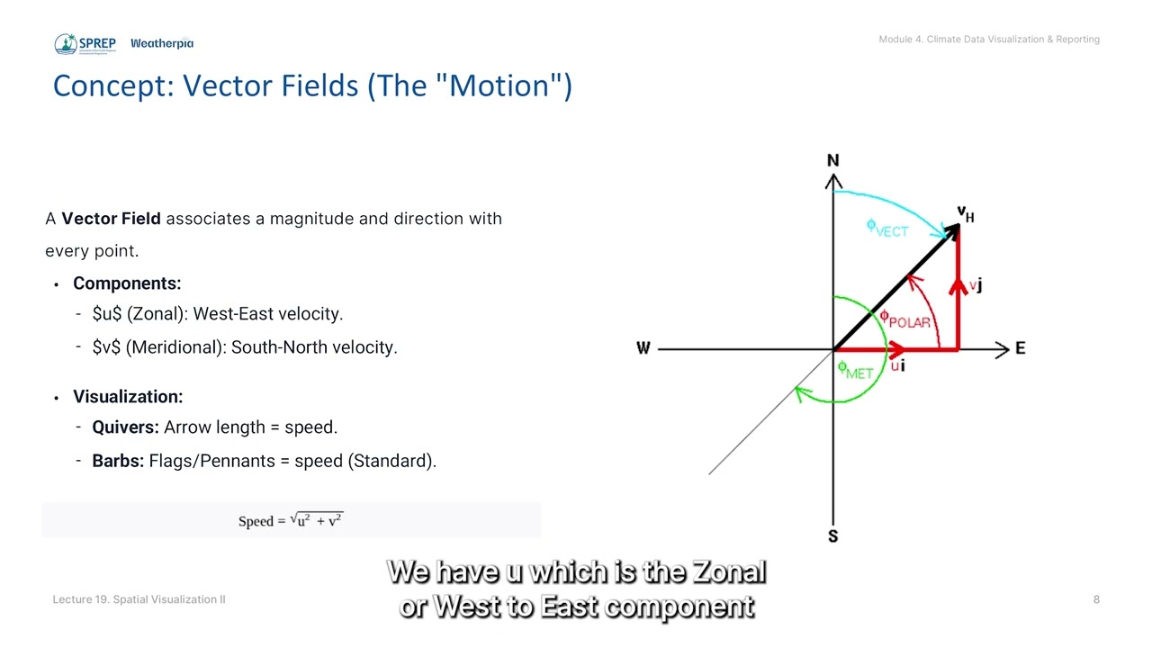
Lecture 19: Spatial Visualization II: Advanced Contour & Vector Plotting
Equips participants with Open Source tools to create advanced spatial maps, aiming to enhance national sovereignty over climate insights.
The hidden power of Location Intelligence

...otherwise stay hidden.#LocationIntelligence #DataVisualization #SmartCities #Geospatial #DataStorytelling
#AfricaTech #UrbanPlanning #DecisionMaking

The Pacific Planners Forum convened to enable and empower planners and decision-makers to develop evidence-based and effective plans and policies, ensuring that national needs align with regional P...

The Pacific Planners Forum convened to enable and empower planners and decision-makers to develop evidence-based and effective plans and policies, ensuring that national needs align with regional P...


Norway has one of the most decentralized governance systems for land-use planning in Europe, with 357 municipalities serving as the primary land-use authorities. Coordination mechanisms are weak, a...
Launch of Spatial Tools for Planning and Managing Areas to Reduce Biodiversity (14-Nov-2025)

...arget 1 of the Kunming-Montreal Global Biodiversity Framework (KMGBF) and apply spatial tools for planning and managing areas of conservation to reduce biodiversity loss. Parti...
SPATIAL TOOLS FOR PLANNING AND MANAGING AREAS TO REDUCE BIODIVERSITY LOSS ONLINE COURSE

Designed to equip you with hands-on knowledge in using ArcGIS Online, Dashboards, StoryMaps, Hubs, and Instant Apps to support Target 1 of the Global Biodiversity Framework.

...ut also on how land and seas are used. 🌍 This webinar explored how **integrated spatial planning** can help design energy systems that work for both people and nature.
Experts...
...e to zero by 2030 through participatory, integrated, and biodiversity-inclusive spatial planning and/or effective management processes. In particular, geospatial data is critic...