▶
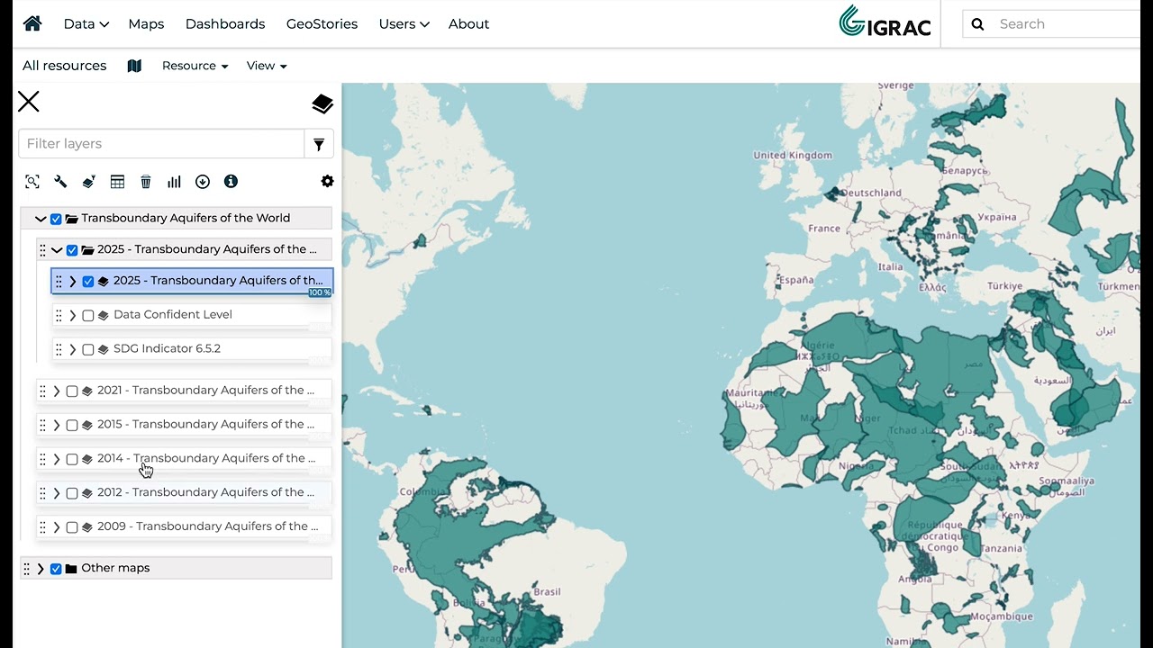
How to download a layer in the GGMN & GGIS?
IGRAC - International Groundwater Resources Assessment Centre
IGRAC - International Groundwater Resources Assessment Centre
Delft
In this tutorial, we will walk you through all the steps to download a layer IGRAC's GGMN (Global Groundwater Monitoring Network) & GGIS (Global Groundwater Information System).
We will explain how to download either polygon or raster layers. In the first example, we show how to quickly download a shapefile. After that, you will see how to export data as GeoJSON, CSV, TIFF, etc.
💻 https://ggis.un-igrac.org
🔗 https://un-igrac.org
📧 info@un-igrac.org
#groundwater #data #opendata #water #informationsystems